
Blog
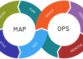
Let’s talk about MapOps
I’m not going to lie, I’m slowly mutating into one of those GIS high-level manager types who work less on real day to day map work and more about concepts and frameworks…even, at points strategizing. I hate it, give me some kriging interpolation or some hardcore viewshed analysis any day, but one thing is becoming...

Using QGIS in the Cloud with Amazon Web Services (AWS)
It’s easy to run a popular open-source geospatial suite on this hosted cloud platform: AWS. QGIS is a great piece of software, and I would really recommend you try it out if you are currently working with ArcGIS, MapInfo or any other piece of GIS software. However, if you don’t have admin rights on your...
Ground Control Points as a Service?
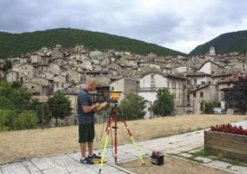
Ground control points for aerial, satellite, and UAS imaging and remote sensing projects, large and small, can be downloaded on-demand—what a service! We look at an example service, and link to an upcoming webinar of the subject. With cameras pointed at Earth from hundreds of cubesats and tens of thousands of UAVs, in addition to...

Lemons, Lemonade, and Learning: Using Internet Resources During Distancing Downtime
In addition to working on this newsletter and serving as the editor of xyHt’s Located section, I help other clients with freelance work. My main client is a builder/developer and thanks to the current economic climate, I’m experiencing some downtime due to building projects being delayed. I suspect I’m not alone in experiencing this. As...

xyHt Weekly News Links: 06/19/2020
*Click here to visit xyHt’s Virtual Trade Show* Recovery is Coming for Civil Construction 5 Questions on the Synergy of BIM and GIS 3D Laser Scanning Puts Crime Scene in the Courtroom New Precision 3D Topo and Hydro Software Microdrones Invites You to Play the Ultimate Surveying Game Show: SURVEYOR SAYS.

More on the Datum Epoch
Editor’s note: Our April feature “Datum Epochs, and How to Understand Them” by Richard Maher, generated a lot of interest, and readers asking for more on geodesy fundamentals. One letter to the editor provided more detail on keys points. In the interests of providing multiple perspectives, we present the following from Steven J. Martin as...
Advertisement