
Blog
Drones & Surveying Flood Zones
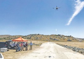
In Juniper Flats, CA, county land surveyors use UAS to save tax dollars and project times and to improve public safety. Photo above: Steven Lewis, Trish Ortega, Paul Clements, Claudio Padres of RCFC & WCD; Sebastien Borghini of Microdrones; Dan McMahon of Allen Instruments. Joshua Tremba does a lot of mapping; he’s the supervising land surveyor...

xyHt Weekly News Links: 8/11/17
TerraGo and Laser Technology Partner to Integrate Industry-Leading Rangefinders with Advanced Field Data Collection Apps GeoCue’s GNSS kit for drones provides survey-level accuracy Draper equips UAVs with vision for GPS-denied navigation 3D Robotics Joins Forces with DJI and Launches UAV Data Solution
Photogrammetric Engineering at The National Polytechnic Institute
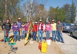
A profile of their surveying and photogrammetric engineering program Featured image: IPN students doing field work for a class at the National Autonomous University of Mexico in February, 2012. Credit: Roberto Garcia. The Superior School of Engineering and Architecture, Ticomán Unit, is located in the north of Mexico City, Mexico, and offers a degree in surveying...
Don’t Buy a Drone
Instead, invest in a fleet of drones. (Apologies for the clickbait headline!) While I was talking to a surveyor whose firm employs UAS in their work, he mentioned the different models of the craft they have. I interrupted him: “Just how many drones do you have?” “16” was the answer. This got me thinking about...
Geomatics at Nicholls State University
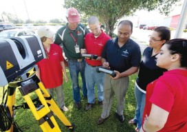
A profile of their geomatics program Above: Students receive instructions on laser scanning. L-r: Jessica Freeman, Kent Hebert, Paul LeBlanc, Dr. Balaji Ramachandran, Monica Crout, and Ann Hebert. Nicholls State University in Thibodaux, Louisiana, initiated its new four-year Bachelor of Science degree program in geomatics during the summer semester of 2003. This program is a...
xyHt Weekly News Links: 8/4/17
Dewberry Honored for Special Achievement in GIS Reps. Westerman and Moulton Introduce Bipartisan Geospatial Data Act | Congressman Bruce Westerman GeoCue Announces GNSS Direct Geopositioning System for Low Cost DJI Drones Nearmap Provides High-Rez Oblique Imagery and 3D Products in Ready-to-Use Service ILMF Call for Papers Deadline is August 14! Congressman Doug Lamborn Addresses MAPPS...
Advertisement