
Blog

xyHt News Links: 5/20/16
Teledyne Optech and GeoShack sign North American distribution agreement CHC launches high-end GNSS receiver for science, surveying HP Delivers World’s First Production-Ready 3D Printing System COPTRZ™ Launch: Changing The Face Of Construction With Drones Optech Eclipse to be introduced to international audiences at GEO Business UK Esri introduces high-precision GNSS mobile GIS software
Ten Minutes
Invest time in the future of the profession—fill out the questionnaire! Editor’s note: This column continues to provide monthly coverage of the Forum on the Future of Surveying (FFOS): a national initiative with representatives from 15 key surveying-related associations to examine paths forward for the profession. See the first installment in our March issue. One...
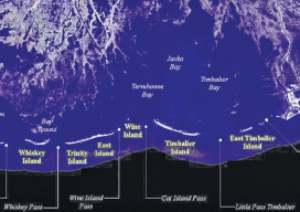
Crossing the Barrier
Above: The Barrier Islands off the Gulf Coast are threatened by coastal land loss. A Louisiana university overcame a barrier facing scientific research of coastal land loss—with a UAS. “We are losing an acre of coastline every 30 minutes,” says Dr. Gary LaFleur Jr., associate professor of biological sciences at Nicholls State University in Louisiana. And...

Using CartoDB
Above: This choropleth map of the distribution of street trees by neighborhood in Porland, Oregon, was created in CartoDB in eight minutes, using public data. From creating a map in eight minutes to creating market predictions based on streamlined analysis. Among the many mapping programs available, CartoDB stands out for its ease of use and sophistication....
xyHt News Links: 5/13/16
NovAtel launches 40-centimeter correction service, TerraStar-L Harxon releases rover radio for GNSS/RTK and precise positioning Teledyne Optech introduces low-cost, automated airborne surveying at GEOINT 2016 IMAGINiT Technologies Releases 2017 IMAGINiT Clarity Family of Products Insitu and PrecisionHawk form commercial drone alliance Monitoring Earth’s Magnetic Heartbeat

Primed for Growth
Aeryon epitomizes the current and coming uprising in UAS. The global UAS market (according to MarketsandMarkets) is set to grow at a 34.36% compound annual growth rate from 2015 to 2020, with UAS shipments to reach 3.8 million units in 2020. A new report from the FAA backs up this forecast, with a somewhat lower...
Advertisement