Aeryon epitomizes the current and coming uprising in UAS.
The global UAS market (according to MarketsandMarkets) is set to grow at a 34.36% compound annual growth rate from 2015 to 2020, with UAS shipments to reach 3.8 million units in 2020. A new report from the FAA backs up this forecast, with a somewhat lower prediction of sales of commercial sUAS to reach 2.7 million by 2020. The FAA report notes that, once a framework for beyond visual line of sight operations is in place, projected market sizes could well be higher than this forecast.
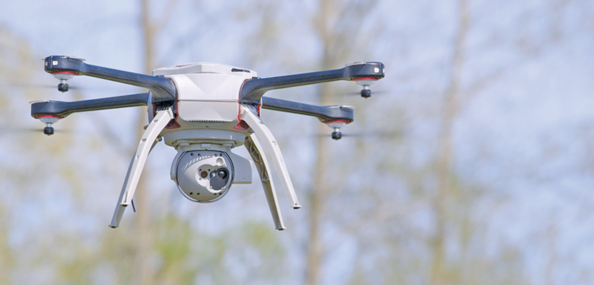
Aeryon SkyRanger with stabilized dual EO/IR high-resolution cameras.
Aeryon Labs of Waterloo, Ontario is a prime example of a company driving this growth. They provide sUAS to civil and military customers, resellers, and other commercial business partners globally. With the recent addition of $60 million of investment from Summit Partners, a global growth equity firm, Aeryon is positioned to take advantage of the explosive growth of the UAS market.
Let’s take a look at Aeryon’s SkyRanger and two examples of this sUAS in action.
Pro-grade Quadcopter SkyRanger
| Flight time: | Up to 50-minute endurance with payload, continuous operation model |
| Wind tolerance: | 40 mph (65 kph) sustained, 55 mph (90 kph) gusts |
| Temperature range: | -22°F to 122°F (-30°C to 50°C) |
The SkyRanger is a ruggedized and weather-sealed sUAS with several features that make it suited for professional sUAS mapping and surveying applications.
An interesting and useful feature of the craft is its folding design that offers easy backpack deployment. All major components, including payload, battery, arms, and legs can be field-assembled without tools. Navigation is point and click or autonomous, and flight plans include “follow-me” and autogrid
mapping modes.
Aeryon offers a line of sensor payloads to meet applications, including stabilized, simultaneously streaming dual EO/IR high-resolution cameras. Custom sensor packages are available, including electrochemical and infrared imaging gas and liquid detectors, useful for pipeline monitoring and a host of environmental sensing applications.
Applications for Aeryon’s sUAS abound: surveying and mapping, inspection and monitoring, change detection, fire and police, public safety, military, forestry and wildlife monitoring, and many others.
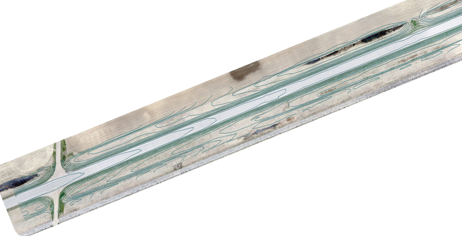
Aerial imagery captured by a SkyRanger of Saskatchewan highway.
Road Construction Preliminary Survey
Canadian company Ventus Geospatial, Inc. employs UAS platforms to provide high-resolution imagery and video for clients across several industries. Its CEO, Stephen P. Myshak, said that the firm based its selection of Aeryon SkyRanger (with electro-optical camera) on its long battery life, high wind tolerance, reliability, and safety features.
In this project in Central Saskatchewan, Canada, an engineering company wanted a method of road survey that minimized exposure of the survey ground personnel to passing traffic on the highway. In fact, a significant data-collection requirement was that no people be on the highway at the time of the flights; this is big deal for insurance and liability and risk reduction.
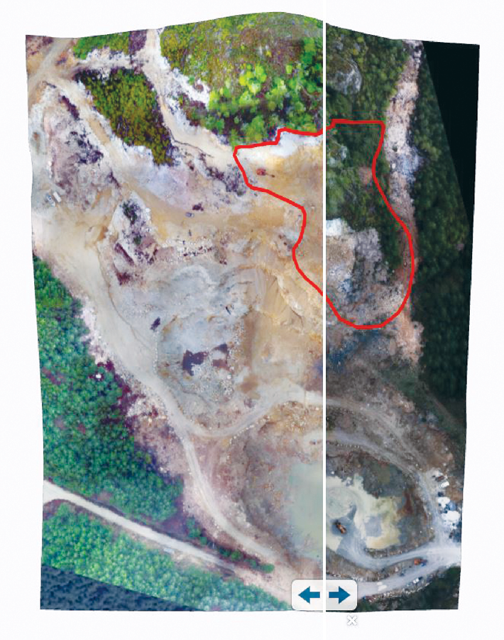
Open-pit mine aerial imagery collected with the Sky- Ranger; note slider bar tool on bottom allowing users to compare visual data over time.
Using UAS technology and very minimal ground control methods, the team was able to survey 37km (23 miles) of highway with no personnel on or near the road surface. The survey, which would typically take two to four weeks, was completed in just five days.
The customer was happy with the increase in speed, reduced costs, and safety—and the increase in survey point density (from 30m to 5cm per point). Ventus was able to achieve this increase from approximately 15 points per 30 meters of road to 50,000 points in the same distance.
They received dense 3D RTK-quality classified LAS point cloud and true color orthorectified orthomosaic imagery of the whole highway. These high-resolution orthomosaics were provided to the customer’s engineering and design department, which were useful for finding culverts, approaches, and power-line crossings.
Open-pit Mining
John Ziemanski is president of British Columbia-based I2S, a GIS solutions provider offering UAS services. Ziemanski explains, “We picked the Aeryon UAS for its ability to handle the rough weather conditions we encounter here in the BC area. What’s more, we needed a VTOL UAS as most of our projects take place in limited access areas, including old growth forests and open-pit mining environments.”
Mining companies in British Columbia are required to provide regular activity reports to the provincial government, including detailed maps and imagery of local topography. I2S has provided GIS and UAV support to the British Columbia mining industry for over four years and see that what would normally take many hours to days to survey now takes minutes to an hour with the UAS.
They use the SkyRanger equipped with SR-EO/IR; this sensor payload offers stabilized, simultaneously streaming of dual electro optical (RGB) and IR high-resolution cameras.
For this project the client received topographic mapping in both hardcopy and digital formats and a web-mapping application with interactive 3D models. Using GIS software like Esri’s ArcGIS, 3D information can be extracted from the UAV data and viewed to be analyzed by the client on location or remotely online.