Jack Dangermond
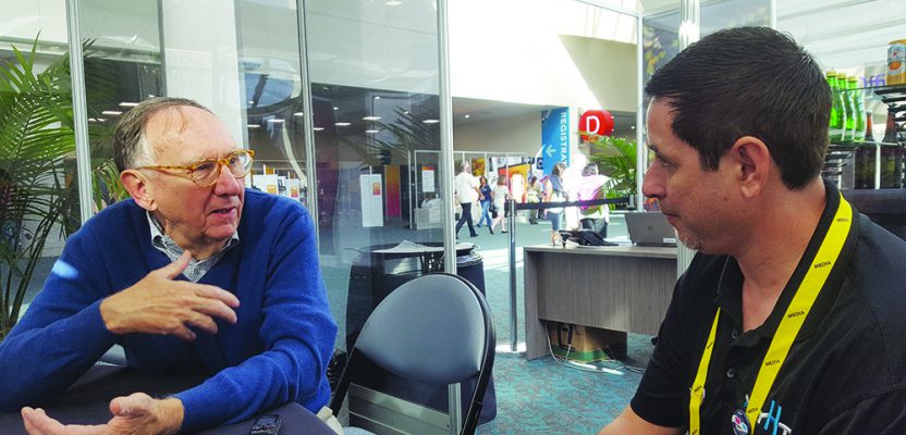
When I was invited by xyHt to attend the 2018 Esri User Conference, there was only one requirement: I had to interview Jack Dangermond, co-founder (with Laura Dangermond, his wife) of Esri.
I was given a 15-minute interview slot on a Wednesday morning, which I hoped would be long enough to get a few big questions in. But Jack wished to continue the conversation for much longer, and he graciously pushed the interview to 45 minutes before he had to leave for his next meeting. Although he had been in constant meetings for two days and had spent the day before those hosting the opening plenary, Jack seemed more than a decade younger than his true age.
ND: Esri is almost 50 years old (I think it will be 50 next year). If you could change one thing, what would you change?
JD: In Esri or in my life?
ND: Both.
JD: I think it was good. I mean, the first ten years of Esri were about doing projects. I had just left university and decided to try to apply the tools that I had used. So, the first ten years were systematically doing real work.
And at that time, there was no computer mapping or any kind of concept of GIS, but we used the concepts of computational geography to do suitability analysis, pick new towns, help design ski resorts … we did a lot of land-planning work in Japan, designed a factory, all kinds of interesting applications. But it was all ad hoc, project by project. And [during] that 10 years we gradually were able to advance the tools, project by project.
In about 1981, one of my colleague’s best friends joined us from Harvard, Scott Morehouse. He had the vision of not wanting to do project work—instead wanting to build a product. So, we took all the resources we had and invested them into building a first-principles GIS product, which was not simply computer mapping or spatial analysis but was a well-engineered technology for doing work that other people could do work with, rather than ourselves.
That shifted the whole philosophy and focus of our company from applying GIS to building tools to help other people apply GIS.
Then, in the midst of that, a very interesting thing happened. We held our first user conference—that was in 1981. In that year, we had licensed the software to a few other people—a large engineering company, a city, a university—and they all came. There were 11 of them. And [they] asked if we would take on the support of software—because at that time, we were a non-profit software organization.
They said, “Would you please take on the job of compiling the software and then providing us technical support, rather than having to be a programmer, or having to have a programmer to be able to run with the computer mapping?”
Right about that time Scott came, and we began spending virtually every cent that we had in supporting him in developing this core technology. Arc/Info, that was the name of it.
I think those first 10 years were most difficult because we chose to do it without any financing. We had $1,100, so every penny counted. Every project. Every work. We couldn’t have a failure. Once you grew up in that kind of a culture, well then, you stay very careful no matter how big you get. We basically run Esri today with the same philosophy that we had in 1980.
Our users said, “Jack why don’t you do this for us, and we’ll pay you some maintenance, and then you could evolve the software and make it better.” So, we fundamentally shifted from doing work, to doing engineering to build tools to help other people do their work better. And those experiences are all very important. Help others do their work better with strong engineering tools and, at the same time, work on problems that are facing the challenges that are facing all of us.
At the same time, it’s in the process of doing the work to support others, as I said—engineer a platform that will address the problems or the challenges that we’re all facing. Those words are carefully chosen in my head here because it becomes very philosophical. That was a shift for me right about 10 years in, to move to a different platform. How to survive, in a way.
ND: What do you see is the future with augmented reality at Esri?
JD: It will be one capability that we support. I see the best capabilities as being a practical tool for, particularly, utility companies who want to see things they can’t normally see. A typical example is: a utility customer goes out in the field and can look down in the ground and can see their utilities right there.
Also, at this conference we’re seeing a lot of people that want to look into buildings and see what’s going on there, or into structures of various types. And while we’re not in the BIM modeling space, that certainly is a use case that people are commenting about.
One of my best friends is a person called Ralph Nader. I don’t know if you’ve ever heard of him.
I met him in 1968 after a Corvair destroyed my Dad’s gas station. He came in before Unsafe at Any Speed. And I’m like, who is this guy?
Anyway, I had dinner with him and Clint Brown, my colleague, about a month ago, and he was quite upset about augmented reality because he saw it as an escape thing. So he’s not really very interested in some aspects of technology. He still types with an old typewriter. I have this little drawer of letters that he sends me that he types and corrects.
He likes people to experience things for what they are: reality, real reality. He was not quite excited about augmented reality and was concerned that kids are going to move from experiencing the real world—nature, smelling, seeing—into this augmented reality that would be full of artificial experiences or non-experienced experience.
I’m both thrilled and nervous to get this opportunity for [AR] being a real tool that can help our users.
ND: What would you want to do next?
JD: I can share that. A big one is augmented reality for urban planning. I see it as a technology for getting citizen engagement. I think it must be balanced with this notion that, with citizens, they can put on some goggles, walk down a street, and see a proposed development, and get engaged in their urban planning and what’s going to be.
I think one of the big things for me is creating a future. My background is landscape architecture and urban planning. And in that space, we’re trying to push geodesign, which is all about linking science to the design field.
You saw some of that on Monday [at the conference plenary] with the ArcGIS group. Urban is a new product which, while collaborative with GIS, is a total standalone technology, a platform for city planners that will be an information system for them to creatively do 3D zoning design—which is the backbone for 3D building design—and do transactions on an integrated smart city in such a way that we could quickly evaluate the alternative consequences of one design versus another.
Geodesign as a background is the idea that would bring all the GI science into the design process and then allow designers to create alternative scenarios and quickly give feedback. And then make rational decisions.
Linked to ArcGIS Urban was this effort we’re doing in community engagement. In addition to planners having cool tools to involve developers, involve realtors, involve the private sector in creating different evolutionary steps of a city, one of our goals is to involve all the citizenry in the city so that people are connected. And understand the—transparently—the consequences of this decision versus that.
Take for example my own little hometown. Some years ago, a few people quietly made decisions about zoning on our western side of the town. As a result, all these big box warehouses that are empty and not clearly performing for our community got built. And if the city only knew or if the citizens really knew—because my town has a lot of people that really care about their town—it probably wouldn’t have happened. And so, we didn’t really have involvement. And this is going on in virtually every city around the world. What we need, I think, is better understanding of the consequences of future scenario.
[My idea is] to tell you what I really dream and hope about: that we leverage all of our geographic knowledge in such a way that it can be set up for people that who make decisions— about urbanization and urban planning or actually any kind of decisions—and enable the involvement of citizenry so they’re smarter.
Then we can stop creating footprints that are only for one objective function and more holistically involve all the environmental considerations, all the social considerations, in an open forum. And I think the language of what’s happened with 3D GIS is enabling that.
ND: You were mentioning that things are now evolving with the 3D GIS. You’ve got this whole really cool 3D ArcGIS Pro. It’s amazing, but I feel it’s missing the 3D basemaps. Is that something you’ve considered?
JD: We’re working on it; we’ll do it with partners. We have to focus on those things that really support our users doing their work better.
ND: But it’s going to be tough because there are going to be so many expectations for levels of detail. Everyone has their own need.
JD: Well, 3D basemaps are something that our users are creating all over the world. You take Singapore, Hong Kong, or Los Angeles—we have tools for them to be able to create these 3D basemaps like you are doing. Some people are doing it in the private sector. [There’s a need to] sort of harmonize all of those into a single basemap for the entire planet. That’s a big job.
And there’s multiple technologies. There’s the 3D features approach. There’s this sort of photometric approach. There’s the voxel approach. There’s, as you know, different technologies, and different people are advocating 3D realities in cities using different footprints.
Our attempt is to be able to support all the different types of 3D models that can be brought into tools that help people do their work better. That’s the way that we see it. And harmonizing 3D continuous basemaps for the entire world—it’s been done for consumers like the Google experiences, but for us, I think it will be a mixture of different data models for different geographies.
ND: How do you stay so fit? You turn up at the plenary on a Monday morning, you go all the way through the day, and you’re still fresh after three days. I’m exhausted already!
JD: I walk every morning. I do pushups, sit ups, all that sort of thing. [Jack smiles and becomes very lively.] Forty pushups, 40 sit-ups, every day. I’m on a mission, and when people are on a mission they have energy.
ND: What do you do for fun besides work?
JD: I like working. That’s my favorite passion. That’s what I like. My passion is my work. I’ve been very lucky because, back in university, I found something I really liked, and it just gets me excited and you see it. You think of it as my work, and actually there’s thousands of people in Esri whose work is just amazing, and I get to tell their story. So, a lot of times people will say, “Oh Jack, you’re doing such a great job.” The reality is I’m trying to bring together and orchestrate an amazing concert.
And yet when I see something wrong [with the software] I’ll contact one of the developers like Jeremy Wright or Nathan Shephard and say to them, “Look, I think you might need to change it.” It’s all because I’m so enthused by what you do and Esri does.
Neil Sandler: Are you a Padres fan?
Jacks face starts to look angry, and I feel like we are going to see some of the legendary fire that we are told about, and then it turns into a smirk.
JD: Not really. Dodgers
NS: You probably don’t remember this, or maybe you do. For 31 years we were Professional Surveyor Magazine.
JD: I remember.
NS: You basically told me as a small business owner, “Take risks.” And this is the biggest risk of my life is going from Professional Surveyor Magazine to xyHt, and it was partially because of you and some other people whom we listened to.
You said, “You know what, if you just stay Professional Surveyor, you’re limiting.” Our name was our barrier. We took a huge risk. And I encourage these guys to fail. So, I don’t understand when you say you’re a little risk adverse.
JD: I’ve got a big responsibility, not just to my staff but to all our users. And this is a huge—I don’t want to say burden—let’s say responsibility. We have millions of users who depend upon us doing the right thing. And when you’re in that situation, it’s not something that you can take lightly. Because they depend upon us.
And we’re making maps that run the world. Actually, we’re not making maps that run the world, we’re making the technology that makes maps—maps being the metaphor for all the analytics and decision-making—that are becoming essential infrastructure for many operations.
And it ranges from national security agencies, to military operations, to running utilities, to running UPS. Last year UPS saved 400 million dollars because they were able to squeeze out a little bit more efficiency in their logistics in driving their trucks. And you look at Starbucks. They’re locating their stores. You look at Walmart and all their properties. We looked at every tax agency. All the cadaster.
And these are huge responsibilities: running the cadaster for a county which is now over 2,000 staff that are moved over. You can’t sort of say, shirk the responsibility or treat it lightly. We don’t take it lightly. So we are very careful with respect to money.
NS: You’ve always had good things to say about surveying.
JD: My big interest in surveying organizations—any of your readers—is that they expand beyond simply measurement. I think I probably told you years ago, they’re the salt of the earth and they go out in the field. They do all of the measurement, and they do it professionally and responsibly. And that’s a huge job because it’s setting up the framework and base work of all the other geographic information.
I thought, always with surveying organizations, that they open up; they expand their professional activities and get into geographic information systems in the larger setting. It’s the diversification when I think of it, but it’s also extending the responsibility and the relationship that they have with their customers to be able to invite more knowledge.
It’s not just measurements, it’s also the maps that go into analytics and go into the decision-support field. One thing I’d like to say to your readers is: this field is expanding rapidly. This year we’ll grow over 100 million dollars. So, we’re trending up, not slowing down.
NS: Our largest growth category for readership is the civil engineers. In the last six months, we signed up more than 3,000 new civil engineers as readers. They’re getting geospatial.
JD: That’s an area where I really want to partner with you because this new relationship with Autodesk Corporation you saw on the stage is mind-boggling. People that are engineers in the audience, they came and said, “Wow, this linking between the design and engineering and the whole enablement of GIS into one space is going to transform how we do our work. How we engage with customers. How we offer our professional services. We don’t want to just offer doing a design and give them some drawing or electronic drawings anymore. We want to actually use their information like they did in New York. Or use the water department’s services on doing their actual design in Autodesk.” This is a 10-year project. It’s going to change the fundamental workflow of how people do their work.
A week later I wrote to Jack, to thank him for his time and the interview, he responded with a kind email about meeting me.
How do I know it was really Jack who wrote the letter? He included the line, “I believe that going for a walk every morning is great exercise”!