All posts by Matteo Luccio
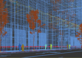
Creative Uses of 3D Modeling
The 3D data collected with laser scanners and digital cameras can be used to create digital and physical 3D models that have myriad applications—from marketing a new building to routing first responders in an emergency.

Why the NSRS and SPCS are being Modernized
Modernization of the National Spatial Reference System (NSRS) is driving the adoption of the State Plane Coordinate System of 2022 (SPCS2022). This is big news for surveyors because 48 states already have a codified SPCS.
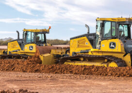
Not Your Father’s Construction Industry
The construction industry, one of the oldest and largest, plays a central role in the development and economic growth of industrialized nations.
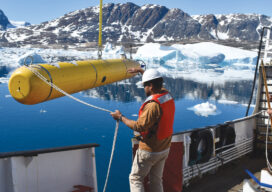
AUVs: Crucial to Seafloor Mapping Effort
In 1775, in Saybrook, Connecticut, the brothers David and Ezra Bushnell built Turtle, a little egg-shaped wooden submarine held together by iron straps, with a 30-minute air supply. The next year, in New York Harbor, Turtle engaged in the first naval battle in history involving a submarine. The first autonomous underwater vehicles (AUVs), undersea systems...

Running Interference
Is Ligado Networks’ proposed terrestrial nationwide network a threat to GPS or a boon to 5G? The Global Positioning System has always faced challenges inherent in its design (weak signal, orbital and clock errors, receiver noise, dilution of precision), as well as from natural phenomena (ionospheric and tropospheric delays, solar flares), local topography and the built environment...
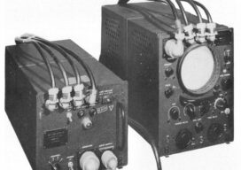
The Return of Loran
An obsolete WWII navigation system is making a comeback In the 1980s, I used Loran-C to navigate on sailing trips off the U.S. East Coast. It had an accuracy of a few hundred feet and required interpreting blue, magenta, black, and green lines that were overprinted on nautical charts. The system was a modernized version, launched...