Category Archives: Aerial/UAS
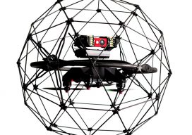
UAS for Confined-space Inspections: the DARPA Connection
Dangerous, difficult, and dirty: these are missions that drones are often tasked for. Let’s look at one of the most dangerous tasks out there: inspection of confined spaces. Boilers, tunnels, storage tanks, underground storage areas, and vaults are a few good examples. How dangerous are these places? Here’s what the National Institute for Occupational Safety...
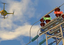
AI-enabled UAS Inspection
AI provides UAS users with biased analytics, the ability to analyze data for insights, and the knowledge of when to act. Artificial intelligence (AI) is at the center of controversies regarding jobs and employment. Will AI take away all our jobs? While some jobs will indeed change or disappear as they have always and will...
2018 Commercial UAV Expo Roundup
I’ve said it before and I’ll say it again: attending the Commercial UAV Expo is the closest you’ll get to drinking out of a fire hose, data-stream-wise, without incurring physical damage. I’m talking metric tons of new and cool UAS stuff. This year I had the honor to be included as a judge in the...
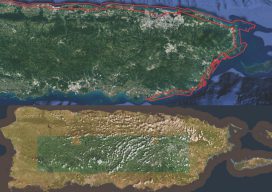
After the Storm
Above image: Puerto Rico was surveyed using the Coastal Zone Mapping and Imaging Lidar system to provide efficient damage assessment. Image courtesy of the Joint Airborne Technical Center of Expertise. Post-hurricane coastal mapping is a complex process made easier with airborne bathymetry. Lately, large storms such as hurricanes, cyclones, and typhoons have been wreaking havoc...
Microdrones Goes Big
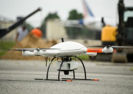
Microdrones Goes Big with Release of mdLiDAR3000, as well as Two New mdMapper Systems Las Vegas, Nevada- Announced today at the Commercial UAV Expo was the launch of the new mdLiDAR3000. It’s the newest LiDAR system from Microdrones that combines the heavy lifting power of the md4-3000 drone with a RIEGL LiDAR and a SONY...
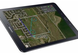
More Than Just Autopilot
Your UAS flight management system affects accuracy in photogrammetry, so get to know what you need. Unmanned aircraft systems (UAS) are arguably the most disruptive technology introduced to the geospatial profession since GPS. Advances in UAS capabilities and in photogrammetry software have significantly reduced the barrier to generating digital surface models (DSM) and orthomosaics from...