So, here’s my idea: as I enter semi-retirement I’m looking for additional revenue streams, ironically to replace clients who are also entering the retirement phase. As long-time readers of Pangaea will note, I’m pretty excited about the possibilities of UAS, so it’s no surprise that I might consider expanding my side business in that area. However, starting any business is fraught with pitfalls; starting a UAS-service business is even more so considering the amount of regulation involved.
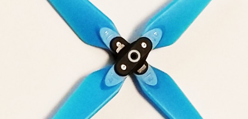
 Given the complex nature of such an enterprise, I’ve been examining the different aspects and taking some incremental steps by doing “sandbox” experiments using a lower-end, but still powerful, drone that I already own: the DJI Spark. Now, before we go any further I must state unequivocally that this platform is absolutely not in any way, shape, or form a serious mapping UAS. This is just for practice before I make a serious investment in a professional-grade UAS like those you see gracing the pages of xyHt (plug, plug).
Moreover, my approach to a possible UAS-service business is more aligned with capturing marketing imagery for my existing land-development and home-builder clients, not necessarily mapping. Don’t worry, I’ll get to UAS mapping soon enough; the October and November issues will be devoted to advances in that area as I’ll be attending both the Pix4D User Conference and the Commercial UAV Expo this fall.
Now that you know the backstory, let’s get back to the Spark. This unit, while not a serious contender for professional-grade mapping, does have features that make it a suitable entry-level visualization tool. Unlike my previous drones, it does have a decent camera (12 MP) mounted on a two-axis gimbal (three would be better, but like I said, entry-level). It also has dual band GNSS (GPS and GLONASS), which is critical. For the full details on its specifications, look here.
Additionally the operational app has interesting and useful photography features pre-programmed into the software. Features like circle, helix, and a variety of panoramas (including, horizontal, 180o and spherical) seem particularly suited for the work I’m interested in. Circle and helix could be applied to individual home-site photography while the panorama features could be employed to illustrate a subdivision with an impressive aerial view.
Getting your kit together. Before I went into the field—practicing as a recreational flyer, not a commercial operator—I knew I would need addition pieces of gear. The unit doesn’t come with a Micro-SD card; I picked up a pair of 64GB ones at Costco cheap. Make sure it’s UHS-I rated and don’t bother getting anything bigger than 64GB.
Also, an extra battery is a must. The Spark maximum flight time (under ideal conditions) is only 16 minutes. As a noob, I typically use up a good portion of that just exploring the control features.
Another item I invested in after a few flights was an additional battery charger. Out of the box the only way to charge the battery was in the drone itself. An additional charger is a big time-saver.
Having a case or backpack to carry the drone and assorted necessities is another must. I bought an inexpensive aluminum case that has plenty of room for the UAS, controller, batteries, charger, manual, small toolkit, and other handy items.
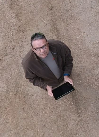
Getting off the ground. First off, I registered my Spark with the FAA; it’s cheap and easy. Once I had read the instruction manual thoroughly and watched how-to videos, I felt ready to take off.
At a nearby field I set up the Spark and was immediately confronted with the “Warning: No-fly Zone” message. Thanks to geo-fencing, the unit found that the nearby County Sheriff’s Department counts as a prison and has a five-mile exclusion zone. I downloaded an app called Drone Buddy that provides operators with critical info like no-fly zones, along with wind speed and weather conditions. I was amazed at the number of local airstrips that count as airports in my area.
Looking to the west, I found fewer flight restrictions, and so off to the mountains I went.
In part two I’ll talk about my further adventures (and misadventures), and I should have imagery to share.
 This article appeared in xyHt‘s e-newsletter, Pangaea. We email it twice a month, and it covers a variety of unusual geospatial topics in a conversational tone. You’re welcome to subscribe to the e-newsletter here. (You’ll also receive the once-monthly Field Notes newsletter with your subscription.)