Category Archives: Energy/Utilities
Mapping Peripheral
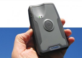
A review of Trimble’s R1, a GNSS Bluetooth peripheral for mobile devices, with multiple options for correction sources. The idea of a GNSS “puck” has broad appeal: a peripheral GNSS receiver to precision-enable mobile devices such as smart phones, tablets, and a variety of purpose-built field-data-collection devices. There is a lot of functional territory between...

Maximizing the Sun
Solar energy grows in part due to aerial imaging and surveying. Solar power is booming in the United States. “Every three weeks,” President Obama said in his 2015 State of the Union address, “we bring online as much solar power as we did in all of 2008.” Geospatial technologies—especially remote sensing and surveying—play an important...
Power Scanning
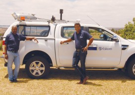
An electric utility in South Africa uses mobile lidar to manage costs and improve information flow. Founded in 1923 and based in South Africa, Eskom is a large company that generates, transmits, and distributes electricity; their customers are factories, mines, businesses, farms, individuals, and even other electricity providers. In fact, Eskom provides 95% of the...
Infrastructure Gets a C from COGO
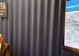
Former governor says U.S. spatial data leadership has slipped. The nation’s spatial data infrastructure gets a barely passing grade of “C” indicating it “requires attention,” former Governor Jim Geringer (R-WY) reported on February 23. Speaking at a news conference at the National Press Club in Washington, Geringer said the national spatial data infrastructure (NSDI), a...
Big Data, Public Data
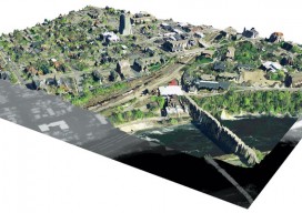
Above: A lidar-derived elevation raster DSM (of Dinkytown, MN) draped by an aerial photo. Free Aerial Lidar, Renewable Energy, an Infectious Mentality At the intersection of renewable energy, big data analysis, geospatial technology, and public data availability stands the Minnesota Solar Suitability Analysis project. Primarily manned by students in the University of Minnesota Master’s of Geographic...
What is xyHt?
Stand in the place where you live Now face North Think about direction Wonder why you haven’t before “Stand” – R.E.M. Why an obscure geodetic expression? It’s not all that obscure—it represents a foundational element requisite to nearly all human endeavor. It touches your life explicitly and in the abstract. All of the ways that...