Category Archives: GNSS/Location Tech

Dr. Gladys B. West: The Autobiography of a GPS Pioneer
The inspiring and touching memoir of a pioneering mathematician, Dr. Gladys B. West, who has been recognized and honored for her key contributions to the development of GPS. Gladys Mae Brown Recently published, “It Began with a Dream” chronicles an extraordinary life and is a celebration of perseverance, hard work, faith, and family. Authored by...

xyHt Weekly News Links 7/17/2020
*Click here to visit xyHt’s Virtual Trade Show* Congress Moves Against FCC’s Ligado Decision Bad Elf Flex™ Adopts the Hemisphere Phantom™ Module Honeywell Refines Navigation Revealing the World from Satellites Common Ground Alliance Launches New Expo
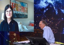
Highlights of the Esri UC 2020 – Day Three Plenary
Following our coverage of days one and two, here are the highlights of the Esri User Conference 2020 – Day Three Plenary. Lots of goals! Sustainable Development Goals A global GIS framework is emerging which brings together many organisations and thousands of data – like a system of systems but some of this data is...

Highlights of the Esri UC 2020 – Day Two
Highlights from Presentations and Exhibits at the Esri UC 2020: plenty of ArcGIS ArcGIS Workforce: Mobile app for worker, web app for dispatcher and project owner there is ArcGIS Platform Mobile app allows use of mobile app to complete to do list Web app allows the creation and management of work for mobile working GIS...
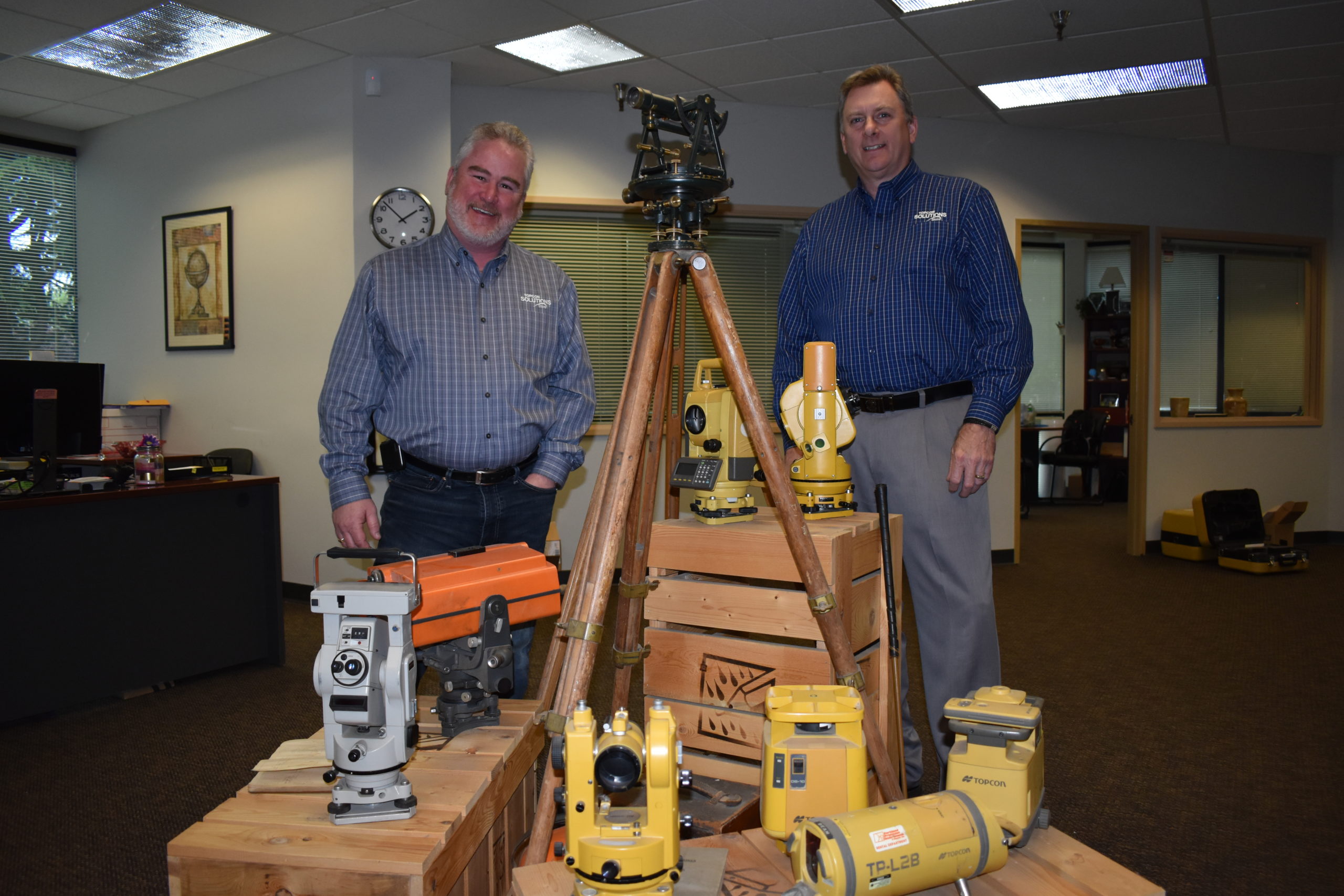
Topcon Solutions Store Leads the Way in Gearing Up
Moves to modernize surveying, engineering, and construction were already well under way—recent events have simply accelerated the process. Many, such as Topcon’s Solutions Store, have used the recent slowdown to adopt new models for workflows, collaboration, distributorships, training, and support to be ready to meet future demand. As the pause button is being released, and...
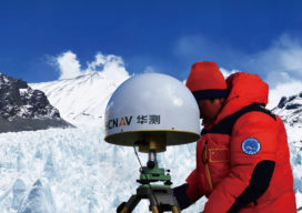
GNSS on Top of the World: Climbing Everest with CHC P5
Surveyors summit Mount Everest with a new generation of GNSS instruments. The fascination with the height of Mount Everest began one morning in 1852 when Radhanath Sikdar, an Indian-Bengali mathematician, rushed into the room of Sir Andrew Waugh and exclaimed, “Sir, I have discovered the highest mountain of the world.” Sikdar was employed by the Great Trigonometric Survey of India...