Category Archives: Surveying
The Three Es
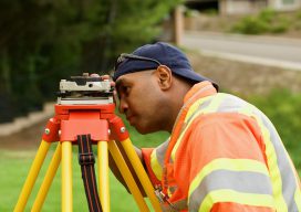
Above: Santiago Canyon College student Scott Givens learns land surveying with the school’s industry-leading technology. Educate, equip, and empower our apprentices Recently I accepted the position of program facilitator for the Surveying and Mapping Department at Santiago Canyon College (SCC), Orange County, California. At SCC we lead by three simple words. First we educate, then...
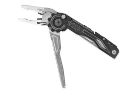
Gift Ideas for Geospatial Pros: Nifty, Thrifty, and under $50
Once again we offer up some gift-giving ideas for the geospatial professional in your family or circle of friends, or just to treat yourself—you deserve it, right? The links for each item below all go to Amazon, but choose your own vendor. Prices are accurate at the time of writing. Also, check out the Located...

History – Art – Community (Updated)
A community gathers for the dedication of Dave LaMure Jr.’s sculpture, “A Vision of Tomorrow,” honoring pioneering surveyor John E. Hayes. Updated: Nov 11, 2018. Audio presentation added at the end of the article. “This has changed my life,” said Dave LaMure, Jr. “It has touched me here,” he added, gesturing to his heart. LaMure...
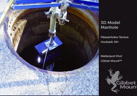
3D Straight Down
Seeing down manholes in detail is an innovation made possible with 3D scanning. [Above image: Deploying the camera system down a manhole to access the Hooksett, New Hampshire sewer system. No breaching of the hole happened, which is a serious OSHA consideration. (The GibbetMount shown here has a steel casing that’s since been upgraded to...
Preserving History, One Monument at a Time
From editor Scott Martin: The original purpose of this guest article by Michael McGee, PLS, et al, was to protect the integrity of this historical monument and its position, which were imperiled by plans to make improvements to the Washington Square Park. Michael and several others, including Dave Doyle, NGS retired geodetic surveyor, quickly researched...
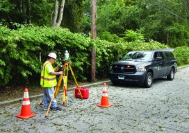
Examining Captivate
Above: A crew chief with BL Companies of Connecticut begins his day working with Captivate. The evolution of 3D surveying field software and Leica Geosystems’ Captivate might surprise you. Editor’s Note: Captivate has been widely implemented among Leica Geosystems users for several years now. In many ways it was a dramatic leap for Leica Geosystems—going...