Category Archives: Surveying
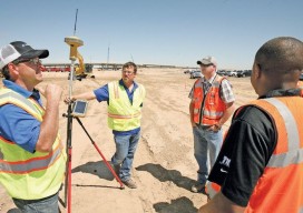
Controlling the Future with Training
To support user training, one company surpasses the usual by extending and supporting information, content, and new skills. Pictured above: Field training can sometimes be the most efficient way of capturing the attention of busy contractors. The surveying and construction industries are dynamic. The way people work today is clearly much different than 50 years ago,...
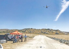
Drones & Surveying Flood Zones
In Juniper Flats, CA, county land surveyors use UAS to save tax dollars and project times and to improve public safety. Photo above: Steven Lewis, Trish Ortega, Paul Clements, Claudio Padres of RCFC & WCD; Sebastien Borghini of Microdrones; Dan McMahon of Allen Instruments. Joshua Tremba does a lot of mapping; he’s the supervising land surveyor...
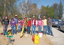
Photogrammetric Engineering at The National Polytechnic Institute
A profile of their surveying and photogrammetric engineering program Featured image: IPN students doing field work for a class at the National Autonomous University of Mexico in February, 2012. Credit: Roberto Garcia. The Superior School of Engineering and Architecture, Ticomán Unit, is located in the north of Mexico City, Mexico, and offers a degree in surveying...
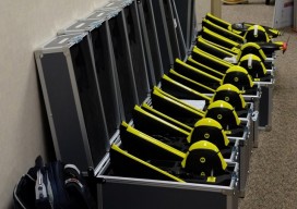
Don’t Buy a Drone
Instead, invest in a fleet of drones. (Apologies for the clickbait headline!) While I was talking to a surveyor whose firm employs UAS in their work, he mentioned the different models of the craft they have. I interrupted him: “Just how many drones do you have?” “16” was the answer. This got me thinking about...
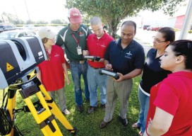
Geomatics at Nicholls State University
A profile of their geomatics program Above: Students receive instructions on laser scanning. L-r: Jessica Freeman, Kent Hebert, Paul LeBlanc, Dr. Balaji Ramachandran, Monica Crout, and Ann Hebert. Nicholls State University in Thibodaux, Louisiana, initiated its new four-year Bachelor of Science degree program in geomatics during the summer semester of 2003. This program is a...
Are HARNs on Death Row?
In the late 1980s, the National Geodetic Survey (NGS) launched a program, in cooperation with State partners, to establish a High Accuracy Reference Network (HARN) across the United States. HARN’s History With the rapidly increasing availability and use of GPS equipment, NGS recognized the need to establish a network of high-accuracy, passive survey monuments with...