Category Archives: Surveying
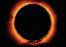
Night in the Afternoon: A US Solar Eclipse
What you need to know about the 2017 solar eclipse The upcoming solar eclipse will leave a 70-mile-wide trail of darkness across the United States on August 21, 2017 (see the map of the eclipse path on pages 44-45). This will be a once-in-a-lifetime event for many people. While another total solar eclipse will make...
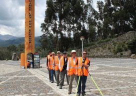
Fire, Ice, and Latitude in Ecuador
A team of U.S. surveyors visited Ecuador to use real-time PPP to pay homage to the 18th-century “Geodesic Mission to the Equator,” one of the most difficult and significant missions in the history of surveying and geodesy. Pictured above: The team of U.S. surveyors on the 2017 Ecuador visit (from back to front): Rich Leu, John...
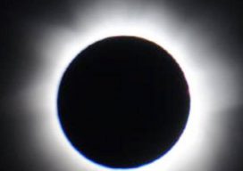
Get Ready for the Solar Eclipse!
In less than a month (August 21, to be precise) folks across the United States, from Oregon to South Carolina, will be treated to a rare total solar eclipse. Here’s the Pangaea guide to watching this spectacular event. Safety first! Don’t even think about watching the eclipse without proper eye protection. Retailers have been busy...
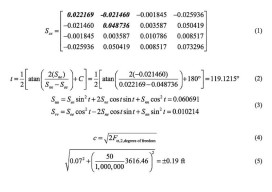
Error Ellipses
Part 2: Components and Increasing Probability In the previous article (April 2017) I discuss the correlation of the coordinate values for a station and how an error ellipse is used to determine the direction of the largest error at a station. In this article I review the components of an error ellipse, the process that...

The Elusive Scope: Business Advice for Surveyors
How to prepare for and meet your client’s needs by keeping your eye on the project scope. I wrote many business-advice columns in this magazine’s predecessor, Professional Surveyor Magazine. Now that I’ve adjusted to writing for the entire geomatics world rather than on just surveying issues, I believe I’ve found one topic that affects everyone...
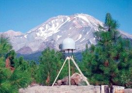
Geodetic Control over Time and Space in California
Interview with Scott Martin, Chief of Geodetic Control and GNSS Surveys, California DoT Above: UNAVCO/PBO station P655 with Mt. Shasta in the background. Matteo Luccio: Scott, what is your relevant background and what is your current role? Scott Martin: I’m a state employee with the California Department of Transportation (Caltrans), in the Office of Land...