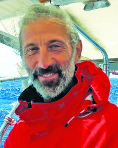
Paolo Cavallini
An Interview with Paolo Cavallini
Paolo Cavallini has been part of QGIS for as long as I can remember. Whenever I’ve had problems or made a remark on the QGIS mailing list, he has been there to help. He is everything you don’t expect a developer to be.
Furthermore, he has now become chair of the QGIS Project steering group, so I took the opportunity to ask him a few questions about himself, how he became chair, and how he manages to be involved in so many different projects, as well as finding out more about his plans for QGIS.
ND: I see you have a PhD in zoology. How did you go from zoology to getting involved with QGIS?
PC: As a zoologist I mostly worked on mammal and bird spatial ecology. This involved a lot of paperwork back in the early 80s, so it was natural, therefore, to start using GIS as soon as usable software was available.
The next jump was abandoning proprietary software and moving to FOSS: at first GRASS, then PostGIS, GDAL, and finally QGIS.
ND: Congratulations on being made chair of the QGIS steering committee. Is chairing the committee something you wanted to do when you joined the QGIS Project?
PC: Thanks for the congratulations; it’s indeed a great honor.
I always try to give back when I receive, so it has been natural for me to help with the project. I’m glad that my volunteer work has been appreciated and that I had more and more opportunities to help push this wonderful project forward, but all nominations I had (first as financial and marketing advisor, the as vice chair, finally as chair) were pleasantly unexpected.
ND: You are involved with IUCN, The World Conservation Union; the European Sustainable Use Specialist Group; you founded GFOSS; you’re with the Associazione Italiana per l’Informazione Geografica Libera & ITPUG, the Italian PostgreSQL User Group; and you’re a charter member of OSGeo – Open Source Geospatial Foundation. How do you find time to fit all this in?
PC: It must have something to do with my attitude. When I use a tool, I try to join the project, not using it passively; therefore, I find myself involved in a number of things. Time is definitely an issue for this, and I had and have to sacrifice some of my spare time for these things. Fortunately, Faunalia, my company, always supported me.
And, very frankly, this has always paid off well on various regards, so no complains at all.
ND: I’ve found 50 scientific papers that you have either written or been involved in, most of which involve open source GIS and environmental studies. How do you see QGIS fitting in to academia? How can it be more widely used?
PC: This is an interesting issue for me. My perception is that universities are more consumers than producers in the GFOSS, including the QGIS ecosystem. I understand their priorities, but still I believe their more direct involvement would result in an even faster and stronger growth for the project and in far better research and teaching. Students and researchers have with FOSS an exceptional opportunity to understand, improve, and implement processes and tools, and my feeling is that this potential is largely underused.
ND: Over the last few years you’ve done an immense amount of development for QGIS. Are you still going to carry on with the development?
PC: The community of developers, documenters, translators, infrastructure maintainers, together with sponsors and donors’ support, is going strong.
I believe QGIS 3 is providing an even more pleasant and productive platform for further, faster improvements. New people are constantly joining us, so surely the development will keep on going at a fast pace.
ND: Is there anything about QGIS that bugs or irritates you?
PC: QGIS community is probably the most pleasant and democratic among all the environments I have been collaborating with. It’s a true privilege working with intelligent, motivated, honest, and straightforward people.
My only regret is about the missed opportunity of many people taking without giving: if everyone that earns his or her living, totally or partly, from QGIS and other GFOSS would give back even a small proportion of what they are getting, our progress would be even more astonishing. But that’s part of human nature, nothing to get bugged from really.
ND: Our readers are mostly from a surveying or geospatial background and are looking at QGIS for its flexibility because it’s less costly than other GIS solutions. What would you say to convince them that QGIS is the right GIS for them? What could it offer?
PC: Besides the enormous range of functions, options, and plugins, all available for free now and forever, I believe the main argument favoring QGIS over other GIS solutions is that it is the fastest-evolving, most strongly supported solution. If something is not available now, it will possibly be in the next version or in tomorrow’s plugin.
And if, still, the tool you specifically need is not available, you can create it (plugin development is surprisingly easy) or fund its development.
ND: What has been the one thing that has impressed you most about QGIS?
PC: The community, really. Over its history, we had a considerable turnover, and every time one developer responsible for a specific section of code left the project I was worried. In fact, new forces kept joining in, and code kept on improving.
Governance is also extraordinary: we are a large group now, each one with its own agenda and potential conflict of interests, but nevertheless we keep on deciding every aspect together, almost always by consent rather than by contrasting position.
ND: What do you think is the future of QGIS? What would QGIS 4 or 5 look like?
PC: Certainly, we’ll keep tracking and taking advantage from the evolution of our base libraries, especially Qt and Python, but only users and developers will guide the process. We probably will favor evolution over revolution, keeping GUI as coherent as possible.
I also imagine there will be more development of accompanying tools, especially for web integration and field work.
ND: Can you tell us of any new exciting features coming in QGIS 3.2?
PC: Not really: what I write today will be obsolete tomorrow, given the rate of development. In principle, 3.2 [recently released] is more of a refinement version, cleaning up bugs in preparation for our next big step: QGIS 3.4, the first long-term release in the QGIS 3 series, giving access to all new QGIS 3 features also to prudent, enterprise, stability conscious users.
QGIS & PostGIS courses: www.faunalia.eu/training.html
Tracking interest in QGIS in Italy (stats): www.google.com/trends/explore?date=all&geo=IT&q=qgis,arcgis