Tag Archives: drones
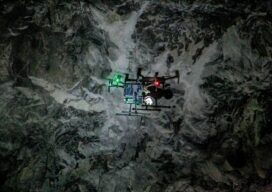
Autonomous Drone Mapping
How interior spaces like mines are being scanned and imaged by a drone that works without a pilot or connectivity. There is a scene in the Ridley Scott-directed 2012 sci-fi thriller “Prometheus” where a deep space exploration crew lands on a planet and discovers an underground labyrinth. They lob a levitating orb down a tunnel,...
The Advantages of “Built Here”
There are reasons other than policy and security to consider domestically produced drones. Yes, when it comes to the drone market there is an almost “default” choice. Having established dominance, it further benefits from price by volume. And then they can invest more in R&D from the increased profits—if they choose to and do not...

From Nadir to Oblique
Spic-and-Span Bridges Inspecting the world’s iconic bridges is becoming a UAV job When it was time last year to inspect the Sydney Harbour Bridge, the steel arc structure that spans the harbor of Australia’s capital, authorities Down Under turned to the latest technology available: drones. “The sky’s the limit when it comes to this technology....

Watching Rotterdam (and More)
What are drones doing Inside Europe’s biggest ports? Doing what they do best, of course, which is to fly. After years of test flights, authorities at the Port of Rotterdam in the Netherlands have given the go-signal to integrate UAVs in its operations, making it the first in Europe “to organize its own airspace...
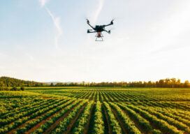
The Future of Aerial Photogrammetry
Rapid advances in technology are changing the way we map from the air, but the 100-year-old technology of mapping by crewed airplanes will continue to fly into the future For thousands of years cartographers made maps using tools that mostly measured angles and distances, allowing for positioning of fixed objects over unknown topography. The earliest...
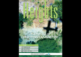
xyHt Magazine Heights 2023
Click on the cover to view the Heights 2023 supplement to xyHt magazine. Articles in the issue include: From Nadir to Oblique: From traditional airplanes to new-fangled gyroplanes, we take a look at several aspects of the aerial geospatial technologies that just keep getting better. The Future of Photogrammetry: While UAVs continue to emerge as aerial mapping vehicles, there...