Tag Archives: geoid
Minimum and Maximum Z Values in ArcGIS Pro
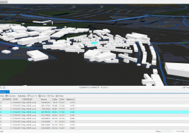
In ArcGIS Pro, why are my minimum and maximum Z values wrong, and how do I fix it? Until recently, this isn’t the kind of question you would expect a GIS user to ask. Of late there have been many innovations in the geospatial software world, and the GIS user is now having to come...

Fundamentals of Geodesy
Part 1: An Introduction Editor’s note: With this article we start an overview of GeoLearn courses offered by Dave Doyle, former chief geodetic surveyor for the National Geodetic Survey and geodesy editor of xyHt. GeoLearn (geo-learn.com) is an online education business helping professionals reach mandatory continuing education requirements and sort through everyday work issues. Dave’s...
Future of Determining Elevation
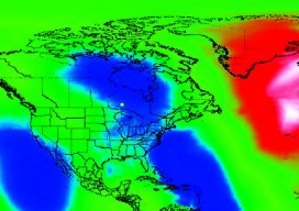
A frank discussion of the different heights used in surveying, what’s inside a geoid model, and how geoid model data is used within GNSS software to produce elevations. Certainly most geospatial professionals who have used Global Navigation Satellite Systems (GNSS) within their surveying workflows have come across the term “geoid model” before. But who actually knows...