Tag Archives: nearmap

xyHt Weekly News Recap: 11/3/2023
AGI GeoCom 2023 Conference set for London in December TCarta Delivers Satellite-derived Bathymetry for U.S. Coastal Mapping Pilot Swift Navigation Adds Unicore to Partner Program Enabling Broader Use of Precise Positioning Technologies Nearmap PropertyVision Makes Industry Data More Accessible to Insurance Carriers GeoWeek 2024 Announces Conference Program Fullerton College Receives First National Science Foundation Grant...
xyHt Weekly News Recap: 09/24/2021
NSPS 21st Annual Student Competition Geo Week 2022 Conference Preview INTERGEO 2021: Relaunch exceeds expectations Teledyne Geospatial Brings CARIS and Optech Together Vexcel Imaging Launches Aerial Camera Solution for Wide-Area Data Collection ConstellR and ScanWorld Partner for High-Value Agriculture Data Data Science Helps Raleigh Avoid Digging Up the Streets Woolpert Develops Guidebook on Airport Response...
xyHt Weekly News Recap: 08/27/2021
Aero-Graphics Contracted by U.S. Geological Survey (USGS) SoCalGas to Use Gas Mapping LiDAR to Reduce Methane Emissions USDA to Use Planet Basemaps for 2021 Growing Season Assessment Maxar Awarded Big Data Analytics Contract from NGA Drone Operations Collaborative Helps Utilities Respond to Disasters Maxar Awarded $26M Contract for NGA’s Open Mapping Platform Hovermap Compatibility Expanded...
xyHt Weekly News Recap: 08/20/2021
Airbus’ UP42 Partners with HyperVerge for AI-based Satellite Imagery Analytics NV5 Geospatial Expands Mobile Mapping Fleet Webinar: Commercial UAV Expo Sneak Peek Future of Enterprise Drone Inspection Arrives with Plug-and-Play Integration NV5 Geospatial’s Michael Shillenn Elected to MAPPS Board of Directors SAM Announces Acquisition of Johnson Surveying and Mapping Esri and National Geographic Society Launch Global Storytelling Challenge Nearmap Aerial Imagery Expands...

Precisely Shot
Aerial imaging, GIS, and GNSS play a crucial role in the success of golf’s 2018 U.S. Open Championship. “Basically, we need to construct a small city—every year and in a different location,” said Timothy Lloyd, senior manager of U.S. Open operations at the United States Golf Association (USGA). Lloyd’s team is charged with planning and...
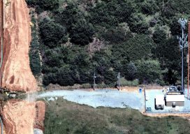
Using Aerial Images to Improve Telecom Operations
Sponsored Content As telecom companies work to keep systems and infrastructure operating, while innovating and adding new capabilities, they must find ways to be more efficient and cut costs. In this post, we talk with Nearmap’s Tim Frank, Senior Director of Marketing, to find out how telecom companies are using the latest aerial imagery technology...