Tag Archives: nearmap

xyHt Weekly News Links: 11/17/17
EdgeTech Introduces New OEM Acoustic Release Components for Customizable Underwater Release Packages Esterline CMC Electronics and NovAtel® partner on new aviation certified GNSS Receiver Hemisphere GNSS Debuts A222 Scalable GNSS Smart Antenna Hemisphere GNSS Announces Atlas® Basic – Instant Global Sub-Meter Positioning for Atlas-Capable Hardware Intuicom Announces Bluetooth BRIDGE™ Engineered Specifically for Autodesk® BIM 360...

Geospatial to the Rescue
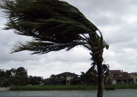
In view of recent weather-related events, we’ll take a quick detour from our series on AR (augmented reality) to cover RR (real reality): the catastrophic 2017 hurricane and wildfire season. The Caribbean islands, Florida, Louisiana, and Texas are reeling from the effects of hurricanes Harvey and Irma. As of this writing, Jose is only brushing...

xyHt Weekly News Links: 8/4/17
Dewberry Honored for Special Achievement in GIS Reps. Westerman and Moulton Introduce Bipartisan Geospatial Data Act | Congressman Bruce Westerman GeoCue Announces GNSS Direct Geopositioning System for Low Cost DJI Drones Nearmap Provides High-Rez Oblique Imagery and 3D Products in Ready-to-Use Service ILMF Call for Papers Deadline is August 14! Congressman Doug Lamborn Addresses MAPPS...

Converging Worlds Data, Imagery, and the Pipes Below
Above: Hydromax USA data (sewer and gas) is combined with Nearmap imagery and Esri software, improving analysis and resource deployment. A data-collection company transforms its services with clear, streaming imagery. By Nicholas Duggan, FRGS, Cgeog (GIS) When you get new aerial imagery, the first thing you do is look up your house. (It’s okay, we...

Mapping as a Service
Fueled by the convergence of cloud computing, digital automation, and internet distribution, subscription mapping creates new opportunities. Subscription aerial mapping sets out to rid the industry of its dated legacies. One in particular is the commissioning of aerial mapping projects. The process can be bureaucratic, expensive, and subject to a long approval. This could lead...
