Tag Archives: teledyne

xyHt Weekly News Recap: 10/21/2022
Teledyne Announces Ladybug6 Cameras for High Accuracy 360-Degree Spherical Image Capture Hexagon and LocLab Work to Accelerate Adoption of Smart Digital Realities Vexcel Imaging Introduces UltraCam Eagle 4.1 Photogrammetric Aerial Camera System Phase One to Launch New Calibration Center at Denver Headquarters Soaring Eagle Technologies Receives Long Distance FAA Waiver for UAS Inspections Common Ground Alliance...

xyHt Weekly News Recap: 10/14/2022
New NSRS Modernization Release Timeline: Mid-2025 Geo Week Calls for Nominations for Excellence in the Geospatial Industry Trimble Changes Headquarters to Westminster, Colorado Mapping Site ShowMyMap.com Rebrands to Mapize.com DOE Announces First Cohort of Post-Secondary Programs to Receive New Zero Energy Design Designation Ashley Hitt to Serve as President of URISA SmartGeo Expo 2022 to...

xyHt Weekly News Recap: 09/30/2022
Teledyne and Seabed 2030 to Study Impacts of Volcanic Eruption in Tonga Greater St. Louis, Inc. Wins Esri Special Achievement in GIS Award Bluesky Takes to the Skies to Capture More Oblique Views of UK Cities Bentley, Genesys to Provide 3D Mapping Capabilities for Cities across India Free Webinar: What’s the Latest in Survey and...

xyHt Weekly News Recap: 06/03/2022
New Company Established: Sony Space Communications Corporation Teledyne to Present Advanced Bathymetric Solutions at CHC 2022 Event 38 Unmanned Systems Launches High-Performance Mapping Drone Leica Geosystems Improves Performance in Airborne Bathymetric Commercial UAV Expo Projects 200+ Exhibitors from Around the Globe

Teledyne Forms New Geospatial Company
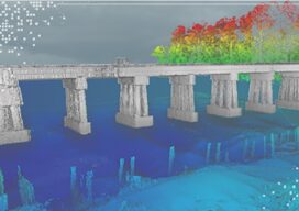
Teledyne Optech and Teledyne CARIS have united to form the new Teledyne Geospatial, offering holistic solutions to seamlessly map land and sea through the integration of industry-leading lidar sensors and world-renowned software workflows. This collaboration empowers customers with a competitive edge in mapping and delivering data products inside of one complete workflow.Ease of collection and...

xyHt Weekly News Recap: 05/13/2022
Geo Week 2023 is Already 80 Percent Sold Out XAG Promotes Drones in Vietnam to Boost Rice Farming While Cutting Fertilizer Use Bowman Expands Transportation Infrastructure Services with Acquisition New Leica Pegasus TRK Makes Mobile Mapping Smart, Autonomous and Easy RIEGL’s Laser Scanning Sensors on Display at GEO Business in London Teledyne FLIR Defense Introduces New Laser Target Designator...
