Teledyne Optech and Teledyne CARIS have united to form the new Teledyne Geospatial, offering holistic solutions to seamlessly map land and sea through the integration of industry-leading lidar sensors and world-renowned software workflows.
This collaboration empowers customers with a competitive edge in mapping and delivering data products inside of one complete workflow.Ease of collection and processing through to final products is enhanced with efficiency-driving AI noise classifying algorithms and real-time quality control.
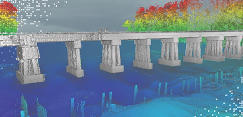
2021 Winner of the MAPPS Geospatial Excellence Award for Technology Innovation and Project of the Year Grand Award, CZMIL SuperNova is the latest topobathy solution from Teledyne Geospatial.Boasting the best depth performance and highest green laser point density in its class and completed by CARIS Base Editor software for seamless data processing capability. Leveraging AI techniques for land/water discrimination and noise classification the CZMIL SuperNova bathymetric solution effectively delivers on marketplace demands for efficient workflow processing.
Discover the NEW Teledyne Geospatial and visit us at www.teledynegeospatial.com.We look forward to discussing how our solutions effectively solve your problems.