Tag Archives: uav
Thinking Ahead
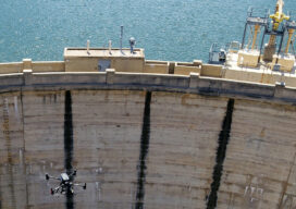
From mapping catchments to inspecting dams, there’s a solid future for UAS technology at public utility companies like the Salt River Project in Arizona
Remote Sensing – It’s About the Safety
If you follow trends in industry that serve our profession, it is impossible to not see articles and advertisements about the use of remote sensing technology. Unmanned Aerial Systems (UAS/drones) tend to be the leaders of the pack for many reasons. However, there are several others, from stationary and mobile terrestrial lidar scanners and cameras,...
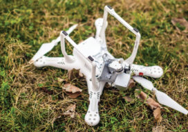
How Not to Crash (or Lose) Your Drone
Lessons from flying, crashing, and occasionally losing, drones

xyHt Weekly News Links: 07/30/2021
Trimble Boosts Flagship RTX Correction Services Performance Common Ground Alliance Releases Newest Edition of Best Practices Guide North Dakota DOT Selects GeoCue for UAS Program Esri to Expand Geospatial Innovation in St. Louis Area Commercial UAV Expo Exhibit Floor Nearly Sold Out dSPACE and Cepton Partner to Provide 3D Lidar Simulation infiniDome Debuts Anti Jamming...
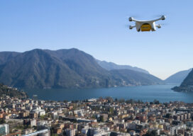
Taking Flight
As drones begin to fill our airspace, Switzerland is figuring out how the skies will remain friendly
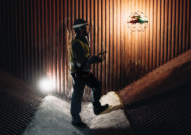
Drones in Confinement
From warehouses to underground facilities, demand for drone inspections in GPS-denied places is rising. The new flying destination for UAVs is the great indoors.