Tag Archives: UK

Rolling Along Virtual Highways
Urban mobility in Europe gets a much-needed boost as cities develop digital twins for their road networks
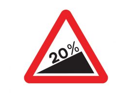
Using Real Road Signs in GIS
At the moment, I am doing a little work with the construction industry that requires road signs and markings placed on a map to show where signs need to move as the site(s) moves through different phases. Now, a real cartographer nerd would say that good graphics and symbolization would negate the need for placing...

Who are the “Geo6” and why will this change UK geospatial?
Around the middle of 2017, there was a mumble in the geospatial industry about how the UK government was going to open up more of its geospatial data. There was even an outrageous rumor that Ordnance Survey was going to have to release its multimillion-pound product, Mastermap. Everyone sniggered but watched the news like hawks....

GEO Business 2018: “Geocoolness” in the London Heat
Trends in geomatics tech and spatial IT at the UK’s premier annual geo conference and exhibition Editor’s Note: GEO Business is an annual conference held annually in London. xyHt’s Europe editor, Nick Duggan has been attending each year, chronicling trends in the geo industry. The event is growing into one of the premier geo events...
Open Source in the UK
Contrary to popular belief, it was neither the UK government nor Britain’s national mapping agency, Ordnance Survey, who started the UK open-source movement. Although open source was present and used in the UK before 2006, it was The Guardian newspaper that started a campaign called “Free Our Data,” which called for the raw data collected...