
Blog
GIS without GIS (Using Spreadsheets)
No, I haven’t gone mad, though some might disagree. I was inspired to write this after talking to a colleague who previously worked for a bank they were tasked with getting proximities to properties using Excel alone. This got me thinking over how much we crank up the GIS, when sometimes it is so much...

Survey Law
Seniority of Title and Forward Search I am often a part of litigation involving surveying services and research mistakes. (I must admit that, in excess of forty years of practice, I have made my share of mistakes performing record research.) I’ve observed five common research mistakes often made by surveyors. This article explains the common...
Surveying Statistics
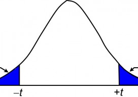
The t Distribution, Part 1 In my previous article I discuss the normal distribution and how its properties can be used to isolate blunders in observations. Recall that the normal distribution is based on an infinite number of observations. However, in practice we never collect a population of data but rather a small sample from...

Signs of Change
Above: This image, created with Woolpert’s online QC tool eQAS, illustrates the ability to review sign data from multiple perspectives and provides lidar and image data at the location of each sign. One collect, multiple uses. A mobile mapping system (MMS) is a versatile tool capable of creating both GIS asset inventories and design-level mapping...

xyHt News Links: 7/24/15
Trimble Unity Software for Water Utilities Adds Support for Advanced Asset Maintenance, BYOD GNSS Receivers and Esri ArcGIS Online Topcon releases ScanMaster v3.05 software upgrade
Top 5 Things to Do When You Install a New GIS Software
So, you’ve just downloaded the new QGIS release, latest ArcGIS, or maybe you are completely new to GIS and wondering how to even get started with this behemoth eating up your (or your employer’s) disk space. Having done this MANY times over the last 15 years of working with geospatial software, I’ve noticed that there...
Advertisement