
Blog

Locata Positioning at Langley Research Center
Locata Positioning will Underpin Future Unmanned Aerial System Research at NASA’s Famed Langley Research Center Locata Corporation announced that NASA plans to install a Locata network (LocataNet) as the core positioning technology for safety-critical unmanned aerial systems (UAS) research at its Langley Research Center in Hampton, Virginia. NASA Langley is tasked with performing rigorous and...

xyHt News: 08/07/15
Leica Geosystems launches new rental program Topcon announces partnership with Ascending Technologies for UAS worldwide distribution Phase One introduces a new camera series Maiden flight pushes boundaries in surveying Researchers to Test Water Drone for Bridge Inspections New LightSquared, Same Agenda, Billions at Stake KSLS Launches Online Learning Portal
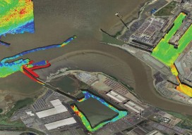
Capturing More with Shallow-water Multibeam
Interferometric sonars are providing a new tool for the hydrographic surveyor in shallow to medium-depth water applications. As we begin to return to normalcy after the deepest recession of most of our lifetimes, many ports, coastal authorities, and inland waterways are starting to look at infrastructure projects that have been kept on hold, and they...
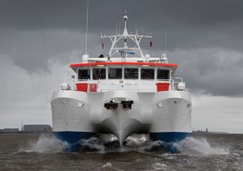
Mapping the Scottish Seabed
Six companies collaborate on a project to bury fiber optic cables under the Scottish seabed, stitching segments using hydrography, bathymetry, and surveying. On land, surveyors face challenges due to rough terrain, human activity, weather, and more. Usually, however, the ground beneath their tripods doesn’t move, they can physically occupy positions, and the air between them...
xyHt August 2015 Issue
Click here to view the August 2015 issue of xyHt magazine
xyHt News Links: 07/31/15
LizardTech GeoExpress 9.5 Launch Announcement UAS Mapping 2015 Reno: CALL FOR POSTERS Trimble Unity Software for Water Utilities ILMF 2016 Call for Papers Topcon releases ScanMaster v3.05 software upgrade International LiDAR Mapping Forum Announces Call for Papers for 2016 Event Pickett Granted FAA Exemption Allowing Unmanned Aerial System Surveys Engineer Supply and Schonstedt Announces the...
Advertisement