
Blog

xyHt Links: 10/3/14
Phase One Aerial Adds iXA-R Camera Platform; Introduces the iX Camera Controller Global Land Carbon Intelligence – New Forest Land Classification Data Set Launched Optech launches new survey technologies at INTERGEO Interactive Esri Maps Explore Poverty in the US and Across the Globe WaldoAir Corp introduces the first complete large format, low cost mapping and...

Visual Intelligence Takes Top MAPPS Honors
By xyHt Visual Intelligence captured the Grand Award at the 8th annual MAPPS Geospatial Products and Services Excellence Awards ceremony. The award was presented at the 2014 Geospatial and Engineering International Marketing Conference in Alexandria, Virginia on September 25, 2014. A software and sensor technology company based in Houston, Texas Visual Intelligence won with their...
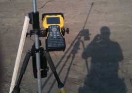
My Dad the Solo Surveyor
Dislocated My dad’s been acting pretty suspicious lately. He comes home after long hours with bruises, bug bites, and scratches. He invites strangers into our den. He also leaves to have these “lunch” meetings. I’m pretty sure that he’s not a superhero or a therapist, so I finally decided to ask what the heck’s going on....

xyHt October 2014
Click here to view the October issue of xyHt

Field Hazards: A Two-Copperhead Tuesday
It’s hot, dang hot here in Georgia. It’s so hot, you wish somebody would hit you in the head with a wet squirrel and cool you off! As a 56-year-old registered surveyor/party chief/instrument man/rodman/cad tech and office cleaner, I’m tired, hot, mosquito bit, chigger infested, and Grand-Central-Station for all of the ticks trying to get...
xyHt Links: 9/26/14
Leica Lino L2G+ Cross-Line Laser: 400% Improved Visibility with Green Laser Technology Arithmetica Launches SphereVision 360 Degree Video Mapping Software New Portable NIR Spectrometer- QualitySpec® Trek, ASD Inc. 3D city models: “No longer just for the sake of it Falling Prices Will Spur Innovation, Competition in High-Precision GNSS Market from Inside GNSS MAPPS Awards 2014...
Advertisement