
Blog
It’s About Time
Australia tech-rebel company Locata is poised to profoundly change the world of positioning, navigation, and timing. In 1994 in Canberra, Australia, accomplished musician and entrepreneur Nunzio Gambale was introduced to a fellow musician, David Small, by Gambale’s cousin who had been giving Small a hand with an interesting experiment. This chance meeting began an amazing partnership in technological development. The scenic capital territory of Australia has its fair...
Q&A with 3D Guru TJ McCue
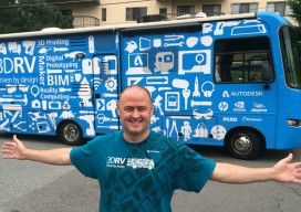
Autodesk is sponsoring an eight-month 3D RV (recreational vehicle) 100 stop tour of the U.S. that celebrates the future of how things are designed and made. Led by TJ McCue, host, writer, and 3D enthusiast, the 3D RV tour is visiting America’s cities, towns and off-the-beaten path byways to explore a powerful and fundamental change...
Future of Determining Elevation
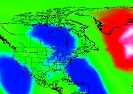
A frank discussion of the different heights used in surveying, what’s inside a geoid model, and how geoid model data is used within GNSS software to produce elevations. Certainly most geospatial professionals who have used Global Navigation Satellite Systems (GNSS) within their surveying workflows have come across the term “geoid model” before. But who actually knows...
UAV News: Recent Court Cases
Here are two recent court cases involving the Federal Aviation Administration (FAA) andusers of unmanned aerial vehicles (UAV). In both cases, the FAA’s position that their 2007 policy memorandum on UAVs, particularly in regard to their being used for commercial purposes, was found to be not legally binding. Rafael Pirker v. FAA In this court case,...
FOSS4G 2014
If you’re seriously into open source GIS, you were (or should have been) at the FOSS4G (Free and Open Source Software for Geoinformatics) international conference held September 8-13 in Portland, OR. An annual event since 2006, FOSS4G is large enough to attract the heavy-hitter vendors (e.g., Google, Amazon and Boundless), yet small enough to enable...

Drone Art: Art Meets the Science of UAS at Elevated Element
Our company, Elevated Element, uses UAS for aerial photography. Our monuments capture project came about when we were contacted by Direct Dimensions, a 3D modeling firm, with the idea of combining the techniques of aerial UAS photography and digital 3D scanning. We chose the Francis Scott Key Monument in Baltimore’s neighborhood of Bolton Hill because...
Advertisement