Category Archives: Aerial/UAS
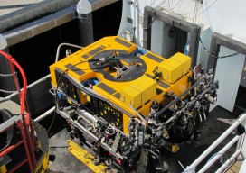
ROPOS: ROV Cool
I recently accompanied a film crew working on a documentary on maritime technologies to the NOAA facility in Newport, Oregon to catch a glimpse of what is widely celebrated as the “coolest ROV in the world.” The Remotely Operated Platform for Ocean Sciences (ROPOS) is the flagship research ROV of the Canadian Scientific Submersible Facility...
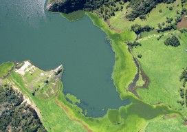
All Over the Map
The regulations and uses of UAVs for mapping in Latin America are as diverse as those cultures, but their drivers are much the same as we see here in the United States. Using manned airplanes for aerial photography and photogrammetry is an especially expensive proposition for countries south of the Rio Grande. The reasons are...

What is xyHt?
Stand in the place where you live Now face North Think about direction Wonder why you haven’t before “Stand” – R.E.M. Why an obscure geodetic expression? It’s not all that obscure—it represents a foundational element requisite to nearly all human endeavor. It touches your life explicitly and in the abstract. All of the ways that...

Tethered Aerostats Provide Another Option in the Sky
Geospatial professionals are able to choose from an increasingly wide array of platforms on which to deploy ever more accurate and smaller sensors. Lately, unmanned aerial vehicles (UAVs) have been getting most of the buzz (pun intended). However, in many situations, high-tech versions of one of the earliest flying devices, tethered aerostats, are a better...

Visual Intelligence Takes Top MAPPS Honors
By xyHt Visual Intelligence captured the Grand Award at the 8th annual MAPPS Geospatial Products and Services Excellence Awards ceremony. The award was presented at the 2014 Geospatial and Engineering International Marketing Conference in Alexandria, Virginia on September 25, 2014. A software and sensor technology company based in Houston, Texas Visual Intelligence won with their...
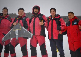
Aerial Imaging in Antarctica
It was quite an adventure: an all-or-nothing mission to map a research station in Antarctica. Like numerous countries around the world, Ecuador’s mapping agency, Instituto Geografico Militar (National Military Geographic Institute of Ecuador or IGM), is a technical institution within the country’s military establishment. The IGM is responsible for developing the national mapping and the geographic...
