Category Archives: Aerial/UAS
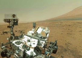
Cardinal Systems’ Extraterrestrial Photogrammetry
On Earth, photogrammetrists can normally use man-made objects in their frame—such as a road of known width or a curb of known height—as scales. When none is present, they can insert such “ground truth” as needed—for example, by placing onto surveyed locations targets that will be visible in their images. On other planets in our...
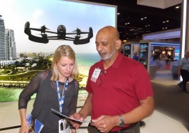
The UAS Scene
The Association for Unmanned Systems International is a 10-year old association dedicated to tracking products, research, and applications for unmanned vehicles. This year’s conference in May in Orlando brought over 6,500 conference-goers to see products and information at the booths of over 500 exhibitors. The primary focus of the conference was airborne vehicles, but marine...
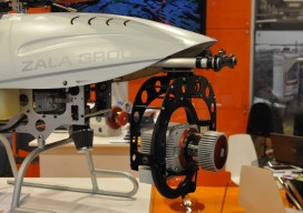
State of: UAS
Multiple names and acronyms are used for this technology: UAS, UAV, and the sadly ubiquitous “drone.” The mapping industry avoids the military connotation of “drone” and prefers UAS (unmanned aerial system) to UAV (unmanned aerial vehicle). UAS encompasses the entire system: the unmanned aircraft and sensor package, the ground control system, the control link, a...
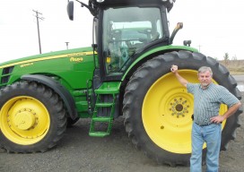
State of: Precision Agriculture
One of the fastest growing areas of application for geospatial technologies, precision agriculture is a way to optimize agricultural production through the application of crop information, advanced technologies, and management practices. Precision farmers map in detail variations in soil chemistry, moisture, and other site-specific conditions, use this information to produce “prescription maps,” then use these...

State of: Aerial
Demand for aerial mapping and its products is higher than ever. While several factors drive the market, the internet is by far the most significant. Nearly everyone has access to the internet and thus access to aerial photography in many formats and resolutions. Thank Google and Microsoft for that visibility and resulting demand. The problem...