Category Archives: GNSS/Location Tech

Sky Control: Lakhta is Russian Forward in Urban Development
Integrated geospatial solutions play a key part in building Europe’s tallest skyscraper. A new chapter in urban development is being written in Russia’s north-west corner. On the outskirts of Saint Petersburg, construction is underway on the new Lakhta Center, an ultra-modern facility that blends commerce, recreation, and cultural activities. In addition to incorporating hundreds of...

40 Under 40, 2017: Danielle Smilovsky
REMOTE SENSING SCIENTIST AND GIS ANALYST AT AMEC FOSTER WHEELER ARIZONA, USA WITH A BS IN ECOSYSTEM SUSTAINABILITY AND AN MS IN GEOGRAPHIC INFORMATION SYSTEMS, Danielle Smilovsky uses GIS and remote-sensing applications to study and analyze ground deformation around the world. She specializes in performing geotechnical land subsidence investigations using InSAR, SAR, lidar, and water...
40 Under 40, 2017: Hayden Howard
VICE PRESIDENT AT COMPASSDATA, INC. COLORADO, USA HAYDEN HOWARD BEGAN WORKING IN THE FAMILY-OWNED BUSINESS of CompassData when he was 15, helping survey ground control with his father and other staff. A graduate of Metropolitan State University, Denver, in land planning (GIS) and aviation, he now directs all aspect of CompassData, including operations, technology development,...
40 Under 40, 2017: Laura Van de Vyvere
PROJECT ENGINEER AT M3 SYSTEMS BELGIUM MANY OF THE SOLUTIONS employed in geomatics sciences are no longer limited to purely spatial measurements. Remote sensing, lidar, InSAR, and even GNSS can now yield far richer data on the physical properties of the objects and mediums that their signals contact and pass through. The related work of...
RTN: Real-Time GNSS Networks Best Practices White Paper
Paper Title: Best Practices for the Development and Operation of RTN – Real-Time GNSS Networks As presented to the Latin America Geospatial Forum (LAGF 2016) – October 5th, 2016 – Mexico City Download here. Abstract: Real-time GNSS networks (RTN) have been a reliable tool for precise positioning, location, and measurement since the late 1990s. From...
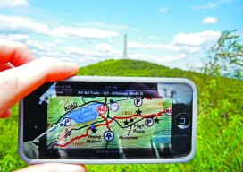
Custom, Portable Maps — Via App!
Software company Avenza has evolved its map products into an app that lets people upload their own map—or download a map of their choice—to their mobile devices, and customize it. Whether for fighting a wildland fire, delivering packages, or exploring tourist sites, using a map should be easy and quick. Well, especially when you’re fighting...