Category Archives: GNSS/Location Tech

Rochester & Associates: In Control with VRS Now
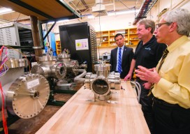
Rochester & Associated uses precise on-demand positions to save time and money. Real-Time Networks (RTN) can be liberating: “When you get on a project site and have on-demand positions, there are so many more possibilities to get the job done rapidly and precisely,” says Jarrod Black, a licensed land surveyor and vice president at Georgia-based...
Project Sextant
A unique research study from pioneers in the development of the GPS system yields a plan for a look into the future of PNT—improving resilience, options, flexibility, and availability. When something like GPS puts positioning, navigation, and timing (PNT) in the hands (and pockets) of millions, maybe even billions, of people across the world, experts...

Pokemon Go: Geospatial Data, All the Time
We want integrated, interoperable systems that are robust and cost-effective Geospatial technology is so entrenched in our daily routines that we often forget we’re using it. I search for map directions at least once a day, whether for a restaurant or for a time of arrival to my daughter’s daycare. And millions of people have...
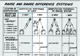
Aerospace Corp’s Role in the Development of GPS
The origin of global navigation from space has roots going back more than a century. Scientists, authors, and visionaries from Tsiolokowsky, Oberth, Lev, Noordung, and Goddard to Arthur C. Clarke saw navigation as a potential benefit of space vehicles and satellites. In the 19th century, author and historian Edward Everett Hale’s “Brick Moons” were envisioned...
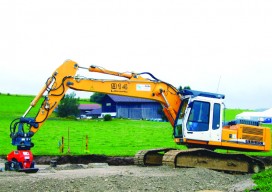
NavCom GNSS: Moving Dirt Just Right
GNSS receivers help steer earth movers, providing users with accurate positions and no complexities. NavCom–a wholly owned subsidiary of John Deere–manufactures GNSS (global navigation satellite system) receivers for land survey, machine control, offshore, and military and government applications. One of its OEM partners is MOBA Mobile Automation AG, a German company specializing in measurement and...
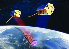
InSAR
How can you monitor broad-area land deformation with high precision? Why, from space, of course. Is it possible for satellites to accurately monitor the motion of landscapes with millimeter levels of precision? What about over wide areas while being frequently updated? If you scoffed in response to either of these questions, you might be surprised....