Category Archives: Space
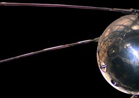
Sputnik and Infrastructure
Today is the 60th anniversary of an event that both enlightened, and, in some ways, frightened the world. But it greatly inspired the worlds of science, engineering, and education. And it also sparked, arguably more than any other single event, developments for the geospatial professions and industries. On October 4th, 1957, a tiny polished metal...
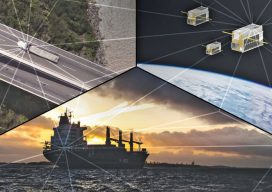
Smallsat Constellations: Sats that Fly in Formation
New applications for smallsat constellations are growing from autonomous formation flying. Space Flight Laboratory (SFL) of Toronto is on a mission to expand the utility of small satellites in a variety of commercial, government, and research sectors. Among its current focus areas is exploit- ing its successful heritage in autonomous formation flying, a technology that...
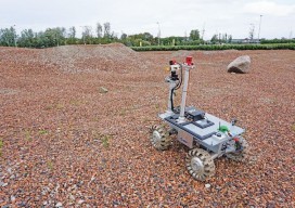
Robots for ExoMars: Drones and Space Exploration
Drones are being used to test a space rover in familiar ways. By Martin Azkarate UAV manufacturer senseFly talked to Martin Azkarate of the European Space Agency about his work developing rover prototypes for planetary exploration, including how he employs a senseFly drone to test these cutting-edge robots. Martin is a space automation and robotics...
Straight on to Mars (and Beyond)
In the last issue we raised the question of whether mankind should go back to the Moon as a way to fuel future space exploration. While that article states the many salient reasons to take this path, many people feel we should aim higher and go straight on to Mars. (For insights on what geospatial...

Back to the Moon? Or—Straight on to Mars?
Editor’s note: at xyHt and Pangaea we’ve been adding “geo-space-al” content into our geospatial mix, and readers have been responding positively. Surveying on Mars is a great example. When you think about it, geospatial technology and space are inextricably intertwined; from GNSS to satellite-based remote sensing, we rely on space-based technology to tackle almost every...
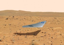
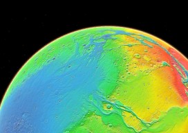
Surveying on Mars
The subject of Mars exploration and colonization is suddenly red hot. What role might there be for surveyors in this, the grandest of human endeavors? Above: The Prandtl-m is a conceptual fixed-wing drone for Mars mapping that will be tested this year from a balloon drop over Earth at an altitude of 35,000m to simulate Mars’...