
Category Archives: Spatial IT/GIS

Stonex: The Quiet Cost of Complexity
For more than two decades, the geospatial and construction technology markets have advanced by adding capability. Each generation of GNSS receivers, robotic total stations, scanners, and machine control systems has delivered real gains in accuracy, speed, and automation. But those gains have often come with a parallel cost that is harder to quantify: complexity. Licensing...
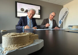
Topcon to Support Scientific Research and Preservation of the Basilica of Vitruvius
Topcon Positioning Systems announces that Topcon Positioning Group in Italy has entered into a scientific sponsorship agreement with the Superintendency of Archaeology, Fine Arts and Landscape (SABAP), a branch of the Italian Ministry of Culture, to support the documentation, real-time monitoring, and enhancement of the recently discovered Basilica of Vitruvius site in Fano, Italy. The sponsorship...
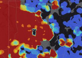
GISCorps Seeks Executive Director to Build on Two Decades of Humanitarian Service
The volunteer-driven geospatial organization is recruiting its first paid executive director as founder Shoreh Elhami prepares for a leadership transition. GISCorps, the humanitarian GIS volunteer program of the Geospatial Professional Network (GPN), is seeking its first paid executive director to help guide the organization into its next chapter. Founded in 2003 by GIS professional Shoreh...

Agentic AI Has to Know Where It Is
Esri’s distinguished product manager for geospatial AI has been shipping AI inside ArcGIS since the ArcMap era. A conversation after this year’s User Conference covers the real difference between an AI assistant and an agent, why Esri built its own governance board around the distinction, and what MCP actually solves for a profession that can’t...

Digital Twins Are a Journey, Not a Product
Esri’s Technology Director for AEC spent roughly three decades on the industry side, most of it at Arcadis, before joining Esri to work the problem from the platform side. His case for digital twins starts with the mix of expertise required inside an AEC firm and ends with a flood-control system in South Florida he...

Reality Capture Is Becoming the New Mapping Process
Esri’s CTO of Digital Twins spent years building the photogrammetry engine underneath ArcGIS Reality before Esri acquired his company outright. A conversation after this year’s User Conference covers what changed when Gaussian splatting arrived, why survey-grade accuracy still matters in an AI-driven capture environment, and what a working geospatial digital twin actually looks like in...