Category Archives: Spatial IT/GIS

Geospatial Tech Reaches the Olympics
Are you watching the most important global sporting event this month in Paris? Then expect not only the world’s best athletes competing for the podium, but also the best of GIS and Digital Twin technologies applied in a sporting event at a grand scale. British company OnePlan is the official digital twin and mapping partner...

Shining a Light Into Black Boxes
AI-infused 3D modeling of substations, pump houses, and other facilities offers utilities immediate benefit By Ben Dwinal Using advanced GIS systems, utilities can create detailed infrastructure models that enable them to deliver services to residents more efficiently and safely. These models include highly granular data about the networks of lines and pipes that deliver electricity,...

The Growing Role of Geospatial Technology in High-Speed Connectivity for All
How mobile mapping is providing a reality capture solution for an ambitious fiber-to-the-home initiative in Ontario, Canada Investments in fiber-to-the-home or FTTH support digital equity to provide new economic, education, and public health opportunities in rural and remote areas. They also present a potential growth market for surveying companies and utilities service providers as countries...

Building the Future
GIS solutions keep one of Europe’s largest urban construction projects on track to the future
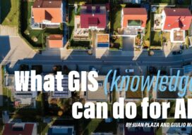
What GIS (knowledge) can do for AI?
Part 3 By Juan B. Plaza and Giulio Maffini Now that we have explored what AI can do for GIS in the first two parts of this series, let’s embark in the more complex task of exploring what a GIS-empowered AI will look like. First, let us clarify that it is our belief that it...
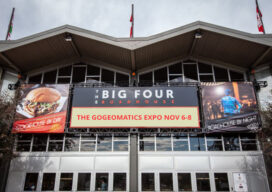
GoGeomatics Expo Puts Canada on the Geospatial Map
In the words of Will Cadell, “Geospatial is changing everything.” That was not only one of the opening lines of a visionary talk by Cadell, founder and CEO of geospatial consultancy Sparkgeo, it seemed to capture the sentiment of exhibitors, speakers and attendees at GoGeomatics’ inaugural conference. Held in Calgary, Alberta from Nov. 6 –...