Category Archives: Surveying
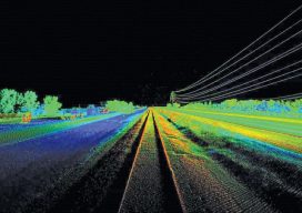
Unmanned Lidar in the Air
A discourse on UAV lidar from the perspectives of a vendor and a user. IS A UAV LIDAR SYSTEM REALISTIC? While UAV lidar is definitely a breakthrough for vendors and users alike, is it enough? Can UAV photogrammetry deliver what is really needed by the surveyor and engineer? Indeed it can, but only in part....

Organic Integration of UAS in the Pacific Northwest
A mapping and design firm in the Pacific Northwest implements UAS in diverse urban and rural environments. Editor’s Note: Integration (or not) of UAS by geospatial firms runs the gamut from outright dismissal of the technology, to firms taking a wait-and-see stance, to companies subcontracting out UAS services. Then there are those, like the mapping and...
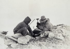
Destiny: I Was Meant to Be a Surveyor
Even though I didn’t realize it at the time, I had two experiences in my youth with direct links to me becoming a surveyor. Were they omens or simply coincidences? There’s no way of knowing, but I like to think they were part of my early survey indoctrination. My father was a high school teacher,...

Wind, Water, and Fire: Hurricane Response in the Geospatial Community
Response, recovery, and rebuilding in the aftermath of hurricanes Harvey and Irma and the unprecedented wildfire season in the West may be the largest combined U.S. disaster response to date. The impacts to Texas, Florida, the broader Gulf Coast region, and many western states will require large national and international effort. We are all involved;...
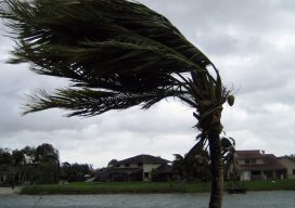
Geospatial to the Rescue
In view of recent weather-related events, we’ll take a quick detour from our series on AR (augmented reality) to cover RR (real reality): the catastrophic 2017 hurricane and wildfire season. The Caribbean islands, Florida, Louisiana, and Texas are reeling from the effects of hurricanes Harvey and Irma. As of this writing, Jose is only brushing...
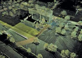
The GeoDude on Scanning Efficiency
A Snapshot from the GeoDude on Rich Data Here’s a comparison of today’s field and office efficiencies—for conventional surveying methods versus laser scanning—as applied to topographic and site surveys. Above: The firm that used scanning for this site survey noted that more than 60% of these types of projects entail scope creep; scanning typically avoids go-backs....