INTERGEO is billed as the biggest specialist event in geodesy, geoinformation, and land management. From a logistical standpoint, that claim is certainly hard to dispute. It’s held in the world’s largest convention center, the Deutsche Messe exhibition complex in Hannover, Germany. The Messe is spread over nearly 250 acres, with futuristic-looking buildings.
The Messe exhibition grounds resembles Tomorrowland at Disneyland, if Tomorrowland covered all of Disneyland—and if Disneyland itself were 50% larger. INTERGEO is held in only a portion of the Messe, but it attracts more attendees (16,000 this year) than the ESRI User Conference in San Diego. In content, it’s similar to the ACSM conferences of yesteryear, only ten-times larger.
What makes INTERGEO truly unique, at least from this surveyor’s perspective, is that there’s no wall between the GIS and surveying communities like at conferences such as ESRI. INTERGEO is all about the complete spectrum of geoinformation, starting from its collection to its management and analysis use. The dominant discipline is surveying, because the rest of the world (aside from the United States) seems to get it that surveyors are the professionals best suited to measure, model, and manage geospatial phenomena.
Geotechnology of All Sorts
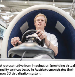
 The 500+ exhibitors fell primarily into one of four major categories: terrestrial surveying instrumentation such as robotic total stations and GNSS; aerial imaging sensors like Microsoft’s UltraCam technology; unmanned aerial vehicles and their use as aerial imaging platforms (fixed-wing and rotorcraft platforms, with the latter type predominant); and visualization/analysis software of all kinds, with augmented reality systems a big draw at many booths.
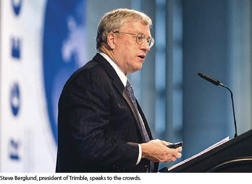
Trimble was the winner of the Most New Stuff announced at INTERGEO, including:
- its next-generation R10 GNSS receiver, along with new versions of its field and office software: Trimble Access 2012.20 and Trimble Business Center 2.80,
- new versions of its eCognition image analysis software and Trident Analyst office software,
- a new version of its Inpho software products for aerial photogrammetry and laser scanning data production,
- the Geo 5 and Juno 5 handheld GNSS devices, adding to current handhelds for mapping-grade data collection, maintenance, and inspection applications,
- the GEDO CE 2.0 Trolley System and GEDO Office 2.0 Software, which provide accurate as-built survey documentation for railway track maintenance and modernization,
- the new TX5 3D laser scanner and SCENE software,
- exhibits of Trimble’s SketchUp and Gatewing UAV technologies—acquisitions made earlier this year,
- the acquisition of Refraction Technology, Inc. of Plano, Texas, a leading provider of seismic sensors and high-frequency data logging systems.
 Other vendor announcements at INTERGEO included:
- Handheld Group: the Algiz 10x, a ten-inch ruggedized tablet and its new Nautiz X1 ultra-rugged smartphone.
- BERNOT Information Technology: the M3 GeoPointer-EGNOS augmented-reality system to visualize design and historical geodata.
- MAVinci: its fixed-wing UAV SIRIUS I system, which was demonstrated next to the INTERGEO outdoor exhibit area.
- RIEGL LMS: the LMS-Q780 long-range airborne laser scanner and the VZ-6000 long-range terrestrial scanner system.
- TerraGo (the GeoPDF people) acquired Geosemble Technologies that specializes in geospatially visualizing unstructured information from any source.
- Carlson Software: Carlson Mining 2013, Survey 2013, Civil 2013, and Hydrology 2013 software systems, plus the Supervisor+ GPS tablet computer.
- Leica: the GS80plus, the smallest and lightest cable-free GNSS receiver on the market; the Zeno CS25 GNSS tablet computer; version 8 of its Cyclone lidar point cloud analysis software; the ScanStation P20 terrestrial laser scanner; and the RCD30 Oblique medium-format camera system.
- Applanix: POS LV 120, the latest version of its positioning and orientation systems for terrestrial vehicles.
- microdrones GmBH: its md4-200 and md4-1000 rotorcraft UAV drones with new supporting software releases.
- Spectra Precision: the Focus 30 robotic total station and new ProMark 120 and 220 GNSS receivers.
- Topcon Positioning Systems: the IP-S2 Compact+, an advanced version of its IP-S2 mobile scanning system, equipped with the new Vanguard Technology GNSS constellation tracking technology.
- Canon: its new Colortrac SmartLF SC 42 large-format scanner with USB 3 connectivity.
- AeroSpy: sensor systems to navigate drone devices on the ground and water autonomously.
- brainLight: its Shiatsu-Massage Chair. Okay, this isn’t directly related to geopositioning, but it’s a good way to relax after a long day in the field!
 Significantly, Microsoft was a first-time exhibitor at INTERGEO, showing its new UltraCam Falcon photogrammetric digital aerial camera system, along with an updated version of its UltraMap photogrammetric workflow software. But many of the discussions I overheard in their booth were about licensing agreements for commercial use of their recently completed Global Ortho program: all of the USA and 14 European countries covered by seamless 30-cm Ground Sample Distance (GSD) color-, 60-cm GSD false-color infrared ortho-mosaics, and a 1-meter GSD digital surface model. This product will bring a new level of large-scale photogrammetric analysis capabilities for all types of applications.
So … lots of cool technology. But, as the title of this review says, the big story was about how effectively geodata is being collected in European countries and turned into geoinformation (what we call GIS in this country). The punch line: In European countries, as well as many others across the world, this end-to-end process is under the supervision of surveyors. I had stepped into an alternate universe where surveying is not only a respected and desirable career profession but also the profession that creates and manages governmental GISs. A lot of this stems from the fact that European professional surveyors are university-educated and undergo extensive apprenticeship certification. A more fundamental reason is the degree of respect that geoinformation has there for its application at all levels of government.
A Confluence of GeoProfessionals
Concurrent with INTERGEO were three other “mini conferences”:
The first national INSPIRE conference. INSPIRE (the Infrastructure for Spatial Information in Europe) is the European equivalent of the United States’ National Spatial Data Infrastructure (NSDI) program, with two important differences: 1) INSPIRE has achieved real-world results, and 2) has involved surveying professionals in key organizational and decision-making capacities. A Spatial Data Infrastructure is basically a giant GIS for an entire country, theoretically eliminating redundant mapping efforts and providing geodata standardization guidelines. INSPIRE has standardized issues of costs, licenses, and open data in 27 member countries, abiding by the PSI guideline (‘Re-use of Public Sector Information’). In contrast, the U.S. NSDI has been “in development” since the 1990s, with very little real progress to show for it.
The SAT NAV Forum, sponsored by the German Federal Ministry of Transport, Building and Urban Development and the Federal Association for Information, Technology, Telecommunications and New Media. This event explores synergies between navigation, IT, and geoinformation.
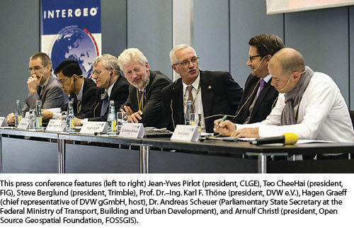
The conference of the Council of European Geodetic Surveyors (CLGE), bringing together surveyors from 36 member countries. This was the first time that the CLGE was held in conjunction with INTERGEO.
What is significant in the convergence of all of these acronyms is the perspective in which GIS is approached in Europe and other like-minded countries. The best way I can describe it is with how automobile technology was viewed in its early days. In the 1910s and 1920s, the Society of Automotive Engineers published pamphlets with titles like, “Adapting the Motor Car for Use as a Milk Delivery Vehicle,” “Design of Military Truck Axles,” and so forth. At that time, the necessity was how to customize the mechanism of self-propelled vehicles for every conceivable use. Over time, of course, standards were developed that enabled the automobile to function for a variety of applications.
To an extent in this country, we’re still in the 1920s as far as GIS is used. At the Esri User Conference, for example, there were 40+ tracks of GIS use, from archaeology to zoology. And I’d be willing to bet that discussion of custom-fit geopositioning standards was a wheel being reinvented in a lot of them. This was all happening, of course, while the surveyors were sequestered offsite at the Survey Summit. But I digress.
The point is that conferences like INTERGEO focus on standards that can be applied across the spectrum of geotechnology applications. And the professionals involved at all levels of those discussions, from techniques to political implications, are surveyors, because authoritative measurement is their—our— bag. From my perspective, that’s a big deal, and the real story to be taken away from INTERGEO.
The countryside surrounding the Messe complex is beautiful with numerous parks and open fields. Hannover itself is ultra-modern, owing primarily to its reconstruction after near-total obliteration in the Second World War. It is a perfect setting for INTERGEO’s 21st-century approaches to geoinformation development and its democratized use.