Pangaea Archives
Mainstreaming Augmented Reality: No Headset Required, Part 1

Augmented reality technology is rapidly evolving into the mainstream; now you can employ and enjoy AR on your smartphone. Let’s start with Apple’s ARKit, a software developers’ kit (SDK) for augmented reality. Apps developed on this platform will work with all iPhones and iPads that use the A9 or A10 processor and are running iOS […]
Don’t Buy a Drone

Instead, invest in a fleet of drones. (Apologies for the clickbait headline!) While I was talking to a surveyor whose firm employs UAS in their work, he mentioned the different models of the craft they have. I interrupted him: “Just how many drones do you have?” “16” was the answer. This got me thinking about […]
Get Ready for the Solar Eclipse!

In less than a month (August 21, to be precise) folks across the United States, from Oregon to South Carolina, will be treated to a rare total solar eclipse. Here’s the Pangaea guide to watching this spectacular event. Safety first! Don’t even think about watching the eclipse without proper eye protection. Retailers have been busy […]
A Good Day with a Bad Elf
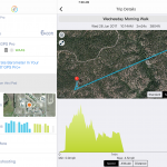
It was a beautiful early summer day, ideal weather to take a road trip to the Pike National Forest about an hour from my Eastern Colorado home. Pike National Forest comprises 1,106,604 acres southwest of Denver and is a frequent haunt of mine for camping, off-roading, and in past years dirt biking and ATV-ing. This […]
Free GIS Training
The ABCs of GIS via MOOC Massive open online courses (MOOCs) provide an affordable (generally free) and flexible way to learn new skills to advance or enhance your career or for your own personal development. The team over at Esri has joined the MOOC movement with five free GIS-related courses that require only a few […]
The Power of Tethered Drones
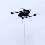
Before the FAA’s Rule 107 allowing UAS use for commercial work, we waited patiently (and often impatiently) for the day when UAS would be “unleashed.” Ironically, now a new class of UAS gets its power from actually being on a leash. Tethered drones use a hardware tether (as thin as a headphone cord) from the […]