Tag Archives: eBee

Saving Alcatraz (Digitally)
The infamous island is under attack by climate change, rising sea levels, and old age. Can scanning it from the sky and on the ground preserve it? When the first functional photogrammetry uncrewed aviation vehicles (UAVs) became mainstream technology around 2013, geodesists and land surveyors around the world adopted these flying wonders as an innovative...
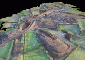
Over Roads and Quarries
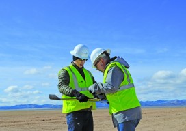
A surveyor with a construction company in Northern Ireland uses UAVs to develop highway construction and for adjoining quarry quantities. Improving infrastructure has become crucial to local and global economies due to increased strain on roads and public transport from a rising population. When GRAHAM Construction and its partner, Farrans, were jointly awarded the contract...
UAVs Planting Trees
… And What That Means for Next-gen Drones Honestly, I don’t pay much attention to unusual uses of UAVs; I focus on geospatial applications. However, after reading the news about a company using UAVs to plant trees, perhaps I should. Let’s take a look at the story and see what it could mean for the...
Don’t Buy a Drone
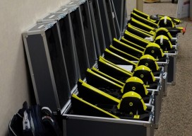
Instead, invest in a fleet of drones. (Apologies for the clickbait headline!) While I was talking to a surveyor whose firm employs UAS in their work, he mentioned the different models of the craft they have. I interrupted him: “Just how many drones do you have?” “16” was the answer. This got me thinking about...
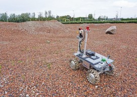
Robots for ExoMars: Drones and Space Exploration
Drones are being used to test a space rover in familiar ways. By Martin Azkarate UAV manufacturer senseFly talked to Martin Azkarate of the European Space Agency about his work developing rover prototypes for planetary exploration, including how he employs a senseFly drone to test these cutting-edge robots. Martin is a space automation and robotics...
UAS: Measuring for Solar
Above: The Mortenson team prepares their senseFly drone for flight. With a UAS, a construction firm finds value—in addition to what can be measured—in real-time assessment and data availability. Surveying plays a crucial role in construction, from initial planning to final as-built verification, often in multiple phases. However, terrestrial survey methods come with challenges for...