Tag Archives: AeroView Services
Above the Mud
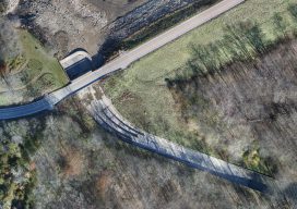
An orthographic image of the exposed spillway at Geode State Park in Iowa at 1″ ground sample distance. To improve water quality in a 500-acre state park, drones are key for surveying drained lakes and the surrounding watershed. Improving water quality is a key part of the Iowa Department of Natural Resources’ (DNR) mission. Planning...
Those Magnificent Men with Their Flying Machines: UAV Data Today
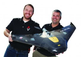
A UAV firm provides surveyors and engineers with CAD-ready files, saving their clients’ resources while increasing accuracy. In case you don’t recognize the title here, it’s a reference to the British comedy film from 1965 based on a competition to fly from London to Paris the fastest. Many of our magnificent men—and women—these days are...