A UAV firm provides surveyors and engineers with CAD-ready files, saving their clients’ resources while increasing accuracy.
In case you don’t recognize the title here, it’s a reference to the British comedy film from 1965 based on a competition to fly from London to Paris the fastest. Many of our magnificent men—and women—these days are being daring by flying with their machines, not in them.
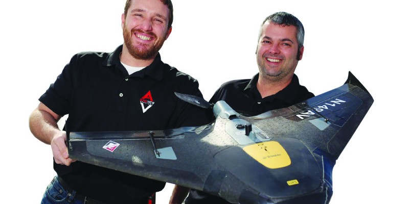
For example, Zach Pieper and Ryan Murguia from Sperry, Iowa, took a leap of faith in February 2015 to form AeroView Services, LLC, an unmanned aerial vehicle (UAV) data acquisition and 4D point cloud company. They’ve been busy ever since.
In fact, they recently expanded, adding a new partner, Curt Schmidgall, and have been steadily hiring engineers and UAV pilots and investing in new technology to keep up with the demand.
Imagination the Only Limit
The jobs AeroView Services tackles are diverse. They include:
- a housing development, saving an engineering firm days of ground work and
- providing a 3D surface that the company could then design from; • a quarry project in which they did in an hour—got stock pile volumes and captured data for the next area their client wanted to strip—what would normally take two to three days to do on foot; and
- a Hawaiian coffee farm looking to expand to high-end “glamping” (glamorous camping), where they overflew the whole site to help with planning and sustainable coffee-production design.
“Imagination is really the only limit to what can be done with UAV technology,” says Murguia. “Often, we develop completely new applications once our clients understand what we can do with the flight data.”
One of the secrets of AeroView’s success is that they provide the UAV data they collect in a file format and size that engineers can use in CAD or a surveyor can load into their controller. “Our clients are ecstatic when they realize we can take the point cloud and put it into a format and size they can use in CAD,” explains Murguia.
AeroView uses multiple software packages for flight processing
Once the engineered design is complete, Quantum Land Design (AeroView’s parent company) performs the GPS data preparation for contractors to build the project. Quantum, which was founded by Murguia in 2012, specializes in digital terrain modeling, 3D machine control, volumetric calculations, and sustainable agriculture design.
Software Enhances UAV Data
According to Pieper, their survey-grade UAV takes overlapping photos and a GPS reading every time it takes a photo. The technology can determine where every pixel in every picture is taken and then stitches those pictures together, matching GPS readings and pixel values between adjacent photos.
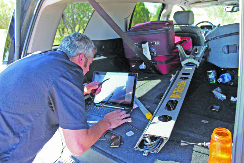
Ryan checks data integrity on a project in Arizona
“From that, we can generate a point cloud, which is effectively a 3D map of the land,” he adds. “So, for every single pixel, we get a 3D survey point with a color assigned to it.”
“We use photogrammetry software to develop the first pieces of the puzzle—the orthophoto and the point cloud from our flight,” Schmidgall explains. “Then from there we take it into Carlson software, and it finishes it all.” It’s turning the point cloud into a 3D surface (that an engineering firm can use in their site design) that is so important to AeroView and Quantum’s clients. Through proprietary methods, the companies are able to reduce the multi-gigabyte 3D model generated by the photogrammetry software to less than 20 megabytes for use in CAD.
Imagination is really the only limit
“We can give clients accurate contours to work from, points in certain intervals that they request, or a 3D surface,” says Schmidgall. “Some just need contours and some want a full site layout. We do planimetrics and volume calculations, as well.”
It’s not cost-effective for surveying companies using traditional methods to map large areas in the kind of detail that we can
The orthophoto, a geometrically correct photo that’s generated, is also a valuable tool for their clients who may need an up-to-date photo of their site or others who need the photos for planning. AeroView can take the multi-gigabyte photo and compress it to work in CAD.
“We also provide watershed analysis and erosion prevention, site design, and mapping, and we can use the data to help a contractor bid a project. We also can generate layout files,” adds Murguia, noting it’s all accomplished with Carlson.
With AeroView’s expanded services through Quantum, they also take the files that they produce, or an engineering firm’s design, and provide the data prep to bring the plans to machine control. The flight data used in the design can be exported into any machine control format the client requires.
Cost-effective Use
“UAVs are a niche thing,” says Pieper. “It’s not cost-effective for surveying or engineering companies using traditional methods to map large areas in the kind of detail that we can, and it’s often not cost-effective for them to get their own UAV.”
This cost is due to many factors, including the amount of regulations associated with flying UAVs and insurance. Pieper and Murguia, who met as a result of former jobs with construction and civil engineering firms, respectively, are both certified UAV pilots, and the company has an FAA 333 commercial operations exemption.
Since its founding, AeroView has hired additional licensed pilots to keep up with demand. Even to run the data due to its large size, AeroView has made a significant investment in processing computers, as well. Aviation and professional liability insurance are another important piece of the business.
AeroView has invested in multiple aerial platforms and sensors, as well. They offer fixed-wing UAVs for large areas, hexacoptors for smaller sites, and even a high-resolution thermal camera for industrial infrared and heat loss inspections. Quantum is a Carlson Software dealer, as well.
This could be why AeroView Services is so busy. In addition to local jobs and the coffee plantation in Hawaii, their team has completed projects across the country and in Canada, Cameroon, and Saudi Arabia.
“We can step in,” Pieper adds, “and offer a surveying or engineering firm that extra service that will make them competitive in that area between a surveyor on the ground and a full-size airplane surveying large areas.”
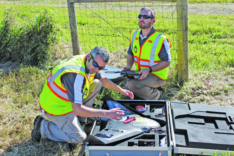
Pre-flight safety checks are an important part of AeroView’s field procedures
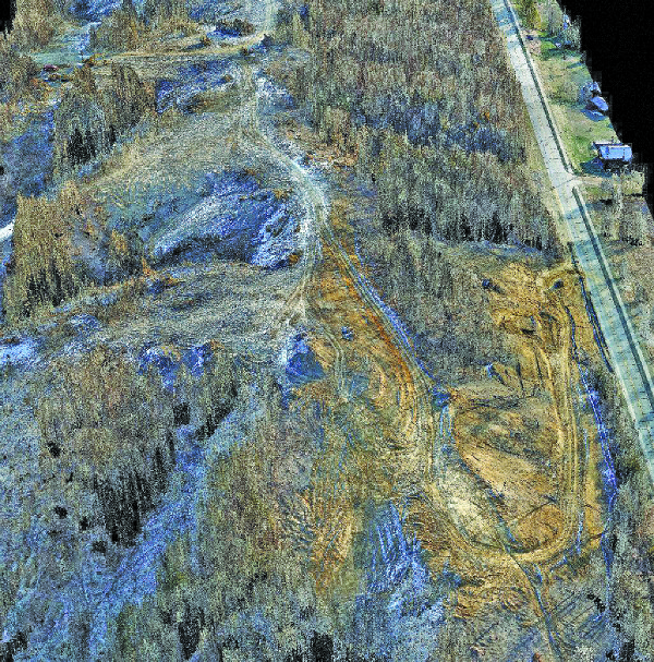
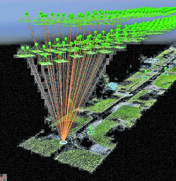
An unedited point cloud from the Green Oak Development
Green Oak Development
Here’s a case in point. Green Oak Development chose an overlook on a Mississippi bluff in Fort Madison, Iowa, for their newest property: a luxury condominium and housing development. While stunningly beautiful, the tough terrain made it their most ambitious yet.
To simplify and speed the planning process, Green Oak, in conjunction with their civil engineer, turned to AeroView Services UAV topographic mapping and orthophotography to provide the lay of the land. They determined that the economy and breadth of services provided by UAV operations would allow them to collect topographic data on the entire site, not just phase one as was the original plan.
Prior to the flight, the surveyor placed ground control points, allowing AeroView’s flight data to match the surveyor’s site control. From just one flight, approximately an hour onsite, AeroView’s technical team developed a 3D surface of the property for the engineer to design from in AutoCAD.
Using the 3D surface provided by AeroView, the civil engineering firm designed the access road, cul-de-sac, and condo layout for the first stage of the development. AeroView also provided an orthographic photo of the property, which the engineering firm found invaluable for use as a background photo in the plan set. Green Oak also used the high-resolution photo for site planning and marketing.
As a bonus, Quantum Land Design took the engineer’s design and developed a 3D machine control model for the earthwork contractor to build new roads and building pads.
As construction progresses, AeroView will continue to monitor construction progress for Green Oak to determine monthly earthwork quantities for accurate and fair contractor payment. As a bonus, the monthly flights are also providing Green Oak’s marketing team with up-to-date photos for use in online marketing and sales presentations.
Once the project is completed, AeroView will fly the entire property again for the engineer’s as-built drawing. The final UAV flight will provide accurate elevation data and an orthophoto. Features such as fire hydrants and storm intakes will be identified in the photo, and coordinates will be provided to the city for inclusion in their GIS mapping program. The engineering firm will use the as-built 3D model provided by AeroView for final drainage analysis and verification that the site was built to plan.