Tag Archives: Boundless

xyHt Weekly News Links: 11/17/17
EdgeTech Introduces New OEM Acoustic Release Components for Customizable Underwater Release Packages Esterline CMC Electronics and NovAtel® partner on new aviation certified GNSS Receiver Hemisphere GNSS Debuts A222 Scalable GNSS Smart Antenna Hemisphere GNSS Announces Atlas® Basic – Instant Global Sub-Meter Positioning for Atlas-Capable Hardware Intuicom Announces Bluetooth BRIDGE™ Engineered Specifically for Autodesk® BIM 360...
xyHt Weekly News Links: 9/1/17
HP Unveils HP Mars Home Planet and New Wearable HP Z VR Backpack Icaros and Agrowing Announce Integrated Drone Multispectral Mapping Solution for Agriculture Crowdsourced Mapping Projects Aid Post-Harvey Disaster Management Start-up Wingtra Expands UAV Solutions to China and US Boundless Donates $100,000 to LaunchCode in Support of CoderGirl Education Program
xyHt Weekly News Links: 6/2/17
Delair-Tech and NIAS have reached an agreement to perform a series of test flights Orbit GT – Orbit GT and x-Spatial, USA, sign Reseller Agreement Allmand Bros. Inc. Expands into the Mobile Generator Market Appeals Court Strikes Down FAA Registry of Recreational Drones on NBCNews.com Announcing a Drone Designed to Assess and Detect Risks in...
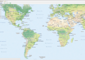
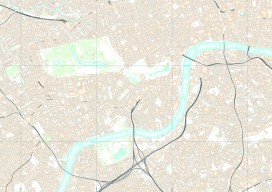
Web Mapping Part 3
Creating a Real Online Map In part 3 of this series (parts 1 and 2 are in the December 2015 and January 2016 issues), we build a web map using Microsoft Windows and Geoserver. We’ll be building this to run on the computer’s “localhost” (http://127.0.0.1), which means that you can run the web map like...
Open Source
The door to open source geospatial software has been unlocked. It’s time to take a peek inside. The open source geospatial movement is not purely about “free” (as in no cost). There truly are other aspects of “free,” as in “free to develop without constraints,” and free access to public geodata without necessarily having...