Tag Archives: drones
From Nadir to Oblique
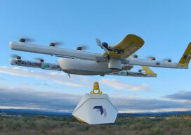
From Buzz to Shush Fighting the drone of drones Drones are hard workers. But because of the noise they make, many people are not fond of them. In a recent survey in Europe, when people were asked about their main concerns regarding the prospect of drone services in their cities, respondents from six countries chose...
xyHt Digital Magazine: April 2022
Like a good surveyor, xyHt‘s March issue covers a lot of ground, bringing you stories about surveying, mapping, UAVs and, this month’s special, a look at how drones are becoming indispensable on construction sites. As always, if you don’t have a subscription to our print edition, or if someone else in the office has snaffled your...
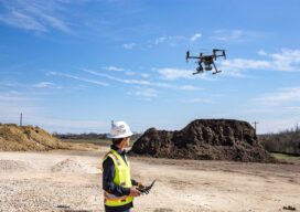
Drones in Construction
For decades the construction industry didn’t change much-and then UAV technologies came along Unmanned aerial vehicles (UAVs) or drones, as they are commonly called, are mostly electric-powered aircraft, which do not require a pilot onboard and are used to perform tasks that are either too dangerous for humans to do or too expensive with other...

xyHt Weekly News Recap: 02/04/2022
National Surveyors Week March 20-26 Trimble Dimensions+ 2022 Call for Speakers Now Open Teledyne Introduces CZMIL SuperNova Lidar Bathymeter Bowler Pons Deploys Cepton’s Smart Lidar Solution to Augment Security for Critical Infrastructure ASPRS Announces February 2022 GeoByte! Riegl VZ-20001 Used for Permanent Forestry Monitoring Aeva Introduces Aeries II, World’s First 4D Lidar with Camera-Level Resolution...
xyHt Weekly News Recap: 09/17/2021
Woolpert Acquires AAM, Global Geospatial Leader Sea Machines Embarks on First Autonomous, Remotely Commanded Voyage by an Ocean Tugboat Bentley Systems Acquires Seequent’s Minalytix Intermap Enhances Analytics for Airbus-owned UP42, a Groundbreaking Geospatial Platform Teledyne Combines Expertise of CARIS and Optech to Deliver Solutions for Land and Sea Golden Software Unveils 3D Drillhole Visualization in...
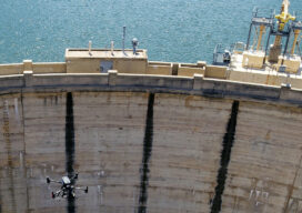
Thinking Ahead
From mapping catchments to inspecting dams, there’s a solid future for UAS technology at public utility companies like the Salt River Project in Arizona