Tag Archives: drones

xyHt Weekly News Recap: 08/27/2021
Aero-Graphics Contracted by U.S. Geological Survey (USGS) SoCalGas to Use Gas Mapping LiDAR to Reduce Methane Emissions USDA to Use Planet Basemaps for 2021 Growing Season Assessment Maxar Awarded Big Data Analytics Contract from NGA Drone Operations Collaborative Helps Utilities Respond to Disasters Maxar Awarded $26M Contract for NGA’s Open Mapping Platform Hovermap Compatibility Expanded...
xyHt Weekly News Recap: 08/20/2021
Airbus’ UP42 Partners with HyperVerge for AI-based Satellite Imagery Analytics NV5 Geospatial Expands Mobile Mapping Fleet Webinar: Commercial UAV Expo Sneak Peek Future of Enterprise Drone Inspection Arrives with Plug-and-Play Integration NV5 Geospatial’s Michael Shillenn Elected to MAPPS Board of Directors SAM Announces Acquisition of Johnson Surveying and Mapping Esri and National Geographic Society Launch Global Storytelling Challenge Nearmap Aerial Imagery Expands...

The Growing Use of Drones… In Crime Scene Investigation
With the sky darkening over an empty parking lot by the railroad tracks in Las Vegas, Nevada, the group of law enforcement professionals leaned in to hear Douglas Spotted Eagle, founder and director of educational programming at Sundance Media Group and a well-known industry figure, explain how drones would be used to capture the simulated...
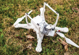
How Not to Crash (or Lose) Your Drone
Lessons from flying, crashing, and occasionally losing, drones
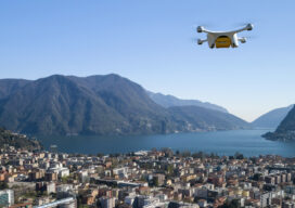
Taking Flight
As drones begin to fill our airspace, Switzerland is figuring out how the skies will remain friendly

Drones in Confinement
From warehouses to underground facilities, demand for drone inspections in GPS-denied places is rising. The new flying destination for UAVs is the great indoors.