Tag Archives: maps
The Best Maps Are Not Behind Us
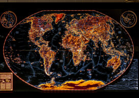
Professional cartographer Evan Applegate shares his mapmaking process, including what’s inside his toolbox. He also tells us why in-person feedback is important to become a better mapmaker.

The Northern Hemisphere of the Celestial Globe (1515)
Maps as Art This whimsical map full of imaginary beasts and creatures is the oldest star map (or star chart) printed in Europe. It is based on the woodcuts by the great German painter Albrecht Dürer (1471-1528) who lived at a time when cartography was considered both as a work of art and a navigational...

Tracking the Paranormal
Mapping Your World Ever wonder where Bigfoot hangs out? What about where most UFOs fly by? Explore both with this per capita UFO and Bigfoot sightings map. The map by Kate Berg, which is featured in the 2023 GeoHipster calendar, cross references sightings of both by county. See what trends or patterns you glean from...

Saving the Big Cats with GIS
Location intelligence is helping livestock herders and lions peacefully share the land in Africa

xyHt News Links: 11/25/16
Avenza Maps Pro now available to industry professionals AeroVironment unveils new commercial drone & support system ideal for oil and gas applications
xyHt News Links: 7/1/16
Topcon announces improved efficiency with Autodesk workflow Septentrio Offers Enhanced Georeferencing Solutions for Drone Aerial Surveys Let’s Make the World a Better Place with Maps Trimble Announces Release of TDC100 Handheld GNSS Data Collector DigitalGlobe and Esri Announce New Long-Term Partnership to Expand World Imagery Map Spectra Precision MobileMapper 50 Combines Smartphone Design with Professional...