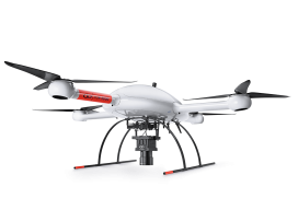
Tag Archives: microdrones

xyHt Weekly News Recap: 07/09/2021
BlackSky’s Technology Monitors Iranian Nuclear Facility Microdrones and GE Launch the GE Industrial Drone Line Ag Department Selects NV5 Global for Geospatial Forestry Contract Graphisoft Releases Archicad 25 Uni-Pact USV Empowers FMS Next-gen Survey Work Esri Announces 2021 ArcGIS Online Competition Winners Satellite Imagery Company Satellogic to Go Public Through Merger New Software System Aims...
xyHt Weekly News Recap: 02/19/2021
GNSS Receiver Keeps Around-the-World Yacht Race Winner in Position USGIF Accredits University of North Georgia New Trimble Total Stations Adds Versatility The Next Generation of Drone LiDAR MAPPS Awards Michael Baker International’s for Excellence NOAA Picks Woolpert to Collect Topo-Bathy Imagery NV5 Geospatial Unveils Cloud-based Data Management Platform
xyHt Weekly News Links: 9/25/20
STAEREA, Microdrones Team Up in Spain Drones and Future-Proofing the Construction Industry The Need for BIM Standards in Digital Construction AI: A Geospatial Revolution Carlson Releases New 2021 Software Riegl Lidar Sensors Aboard New DA42 MPP GeoStar Aircraft Geospatial World Awards 2020
xyHt Weekly News Links: 06/26/2020
*Click here to visit xyHt’s Virtual Trade Show* SBG Systems has New Miniature Sensors for Navigation Microdrones Invites You to Play the Ultimate Surveying Game Show: SURVEYOR SAYS. Mobile Laser Scanning Technology Workshop Postponed ConTech Roadshows Rescheduled Monitoring and Protecting Ecosystems from Space China Launches Final Beidou Satellite; Completes GPS-like Nav System Ground Penetrating Radar...

Drone Surveying in the Ozarks
Crafton Tull, an engineering and surveying firm, was tasked with the daunting job of surveying up to 160 acres to collect data needed to design a new road through the heart of the Ozarks. Professional surveyors can face intense challenges—especially when they need to complete large, complicated jobs in dangerous terrain. That’s the situation that...
Sponsored: Microdrones goes to new ultra heights
Sponsored by Microdrones The new mdMapper3000DuoG VHR takes ultra-high resolution Photogrammetry from higher altitudes. Microdrones is releasing three new Integrated UAV Systems based on the heavy lifting power, resilience and efficiency of the Microdrones md4-3000 aircraft: the mdMapper3000DuoG VHR, the mdMapper3000DuoG and the mdMapper3000 PPK. The company has also updated the mdTector1000CH4 LR with a...