Tag Archives: microdrones
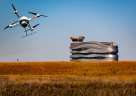
Growing Airports with UAVs
Above: AERIUM Analytics conducts Microdrones flights near the Edmonton International Airport control tower. A Canadian UAS provider uses a special UAV with lidar to transform their airport business into supportive infrastructure operations and runway-scanning projects across North America. The skies above Edmonton International Airport (EIA), Canada’s fifth-busiest airport in terms of passengers, are filled with...
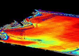
UAS + Lidar = “X-ray” Vision
Image above: The same area as shown in the picture to the right with the ground extracted and the trees filtered out. A construction/survey project proves that UAS-borne lidar can penetrate tree cover to yield accurate ground data with improved post-processing times compared to photogrammetric solutions. I’m the VP of remote sensing at Morris P....
Microdrones Expands in Asia
Microdrones Expands into Asia with Acquisition of Aircam UAV Technology (Press release – January 16, 2019) New York, NY – As part of an ongoing global growth initiative, Microdrones has acquired Aircam UAV Technology (“Aircam”), a 64 employee Chinese company with its main location in Foshan, an hour-drive from Guangzhou in Southern China, and a branch...
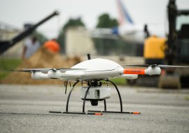
Microdrones Goes Big
Microdrones Goes Big with Release of mdLiDAR3000, as well as Two New mdMapper Systems Las Vegas, Nevada- Announced today at the Commercial UAV Expo was the launch of the new mdLiDAR3000. It’s the newest LiDAR system from Microdrones that combines the heavy lifting power of the md4-3000 drone with a RIEGL LiDAR and a SONY...

Weekly xyHt News Links: 10/27/17
Septentrio launches the AsteRx-m2a and AsteRx-m2a UAS at Commercial UAV Expo WiBotic Announces a New Lightweight Onboard Charger Ideal for Wireless Charging of Smaller Drones Teledyne Oceanscience Introduces a new USV! Welcome to Z-Boat 1250! Solve Gas Detection Problems with Microdrones mdTector1000 CH4 Commercial UAV Expo and Drone World Expo Come Together in 2018 OGC...
Drones & Surveying Flood Zones
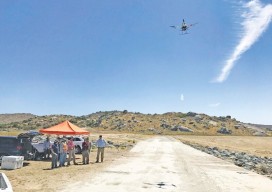
In Juniper Flats, CA, county land surveyors use UAS to save tax dollars and project times and to improve public safety. Photo above: Steven Lewis, Trish Ortega, Paul Clements, Claudio Padres of RCFC & WCD; Sebastien Borghini of Microdrones; Dan McMahon of Allen Instruments. Joshua Tremba does a lot of mapping; he’s the supervising land surveyor...
