Tag Archives: oil
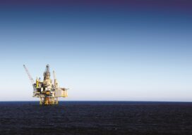
Mapping the Surface of the Ocean?
It is crucial that we keep accurate maps of the ocean’s shorelines, but when my company got a request to map the ocean’s surface 50 miles out in the Gulf of Mexico, my initial reaction was: Why? Isn’t the ocean just the ocean that far out? There aren’t any geographic features or elevation changes. It’s...
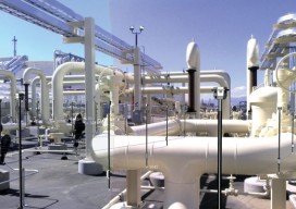
Creating Energy From Images
Geospatial information has long played an essential role in the energy industry, but now a new technology is cutting costs while improving the flow of knowledge. Editor’s note: The energy sector, oil and gas in particular, has grown more rapidly in the past half dozen years than in the past half a century. New fields,...