Tag Archives: SaaS

xyHt News Links: 8/12/16
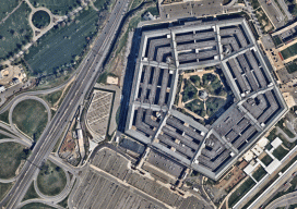
iSTAR 360 degree Measurement Module integrated by imaging companies Australia drifts away from GNSS measurements VGI in Land Administration: A Vision or a Necessity? A New Era in Land Administration Emerges The New State of Smart Cities: Analytics + 3D Visualization as a SaaS Esri and Leica partner to offer GIS/GPS grants to governments Strong...
Mapping as a Service
Fueled by the convergence of cloud computing, digital automation, and internet distribution, subscription mapping creates new opportunities. Subscription aerial mapping sets out to rid the industry of its dated legacies. One in particular is the commissioning of aerial mapping projects. The process can be bureaucratic, expensive, and subject to a long approval. This could lead...
EagleView
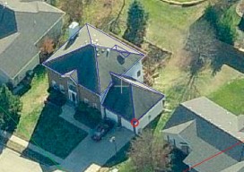
The practical side of on-demand aerial image analytics, with an interview of CEO and president Chris Barrow. A contractor showed up at my house to give an estimate for a long overdue roof replacement. He hadn’t pulled out a ladder, so I asked if he needed mine. His response was, “Since we started using EagleView,...