Tag Archives: sonar
Out of Sight; Not Out of Mind
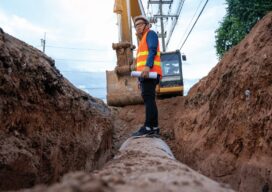
Cities are now creating their own subsurface utility maps to manage their underground assets. But the lack of an open-based geospatial model means that data are often not interoperable. A new mapping standard aims to fix that. In the years since 2004 when a leaking gas pipeline exploded in Ghislenghien, an industrial town in Belgium,...

xyHt Weekly News Recap: 01/21/2022
John Palatiello: 40 Years on the Geospatial Job DOT Makes Historic Bridge Investment Under Bipartisan Infrastructure Law Phase One Unveils Wide-Area Aerial Camera with Global Shutter Sensor Technology Sonardyne Hybrid Positioning Chosen for Vessels Across Energy and Science Seiler Instrument to Expand Presence as a Geospatial Solutions Provider in Iowa and Illinois Kinematic Lidar Data Processing...
Epiphany on the Bow
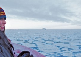
Above: Shannon Hoy on the bow of the RVIB Nathaniel B. Palmer as she crossed through the Bransfield Strait in 2011. Photo by A. Margolin. A student’s journey from marine biologist to ocean mapper. Ever since I can remember I’ve wanted to work in ocean sciences. From when I was a child splashing in the tidal...
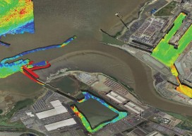
Capturing More with Shallow-water Multibeam
Interferometric sonars are providing a new tool for the hydrographic surveyor in shallow to medium-depth water applications. As we begin to return to normalcy after the deepest recession of most of our lifetimes, many ports, coastal authorities, and inland waterways are starting to look at infrastructure projects that have been kept on hold, and they...
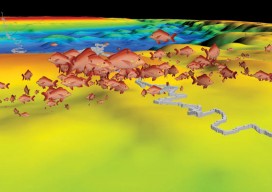
Finding Fish Hotspots
Marine scientists bring multiple technologies together to locate reef fish aggregations, working towards healthy reefs and island economies. The livelihoods of tropical island communities depend on the vitality of reef fishes, either directly through recreational and commercial fishing or indirectly through healthy coral reef ecosystems that support eco-tourism. Yet, over the last several decades, the...
Arctic Quests
Multiple agencies and technologies merge to map a historic region of the Canadian Arctic. Adapted from the academic paper, “Arctic Charting and Mapping Pilot Project 2: Sharing Modern Technologies and Resources towards a Common Goal”, by Andrew Leyzack and summarized by Steven Keesee, with a history sidebar by Jeff Salmon.In April 2011, multiple organizations in...