Tag Archives: Trimble R10
R10 Too! The R10 Model 2 Is Announced
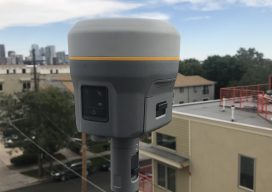
A Flagship GNSS Rover Gets a Major Upgrade The first generation of Trimble’s flagship GNSS rover, the first R10, was announced six years ago at the Intergeo 2012 Conference and Exhibition. While updated incrementally over the years, the R10 Model 2, or R10-2, is a major upgrade. It may look the same, but that familiar...

Creating Energy From Images
Geospatial information has long played an essential role in the energy industry, but now a new technology is cutting costs while improving the flow of knowledge. Editor’s note: The energy sector, oil and gas in particular, has grown more rapidly in the past half dozen years than in the past half a century. New fields,...