All posts by Mike Meiser
Lidar vs.Wildfires in Southern California
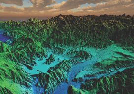
After the 2018 wildfires in Southern California, lidar data was collected to enable risk-mapping assessment and planning, to identify fuel-load reduction programs, and to escalate the emergency assessment of post-fire debris flow hazards. Featured image: This lidar image was taken over Lake Casitas, California. The data are clear: Natural disasters are on the rise, and...